Recently, while we were hiking through Spain, Sami was staying with her babysitters, Martin and Wendy. While there she lost two pounds and had many hikes through the woods off-leash with another dog they were watching, an older Labrador.
We cut our hike a little short to get home to our baby girl. Though she was very happy to see us, we noticed that she was quite depressed her first week home. She was really missing her playmate. Wanting her to be a happy and healthy girl, we decided to look for and adopt a minion for her.
We did a ton of research looking for the right fit and in the end I sent a message to the Second Chance rescue online site asking that the site administrator keep us in mind for dogs in our area that met our criteria: no more than 4 years old, no more than 6 kilos in weight, sterilized if possible, and within traveling distance so that Sami could meet them.
Within an hour of sending that e-mail I received a response from Lisa. The site administrator, Evelyn, had contacted her and she had called around to the rescue shelters in our area and found a pup that met our criteria. She sent me the information and offered to meet us at the shelter to assist with translation, she speaks excellent French and has lived here since childhood. We thought that was a very generous offer. One we gratefully accepted!
Next she offered to drive us there as the place is a bit of a challenge to find. We accepted that offer as well and on the drive to Perpignan yesterday found that she is a wealth of information about EVERYTHING! We are so grateful to her for her generosity, helping us find our new addition and for all of the helpful tips she has offered.
Once we arrived at the shelter, she easily navigated the conversation translating for both Alan and I as well as the shelter president and the on-site administrator. We introduced Sami to Lou (whose name was Leo when we met him) and they got along so well that we decided Lou would definitely be the right addition to the family.
He was listed as a MinPin X, but we think that there is more Corgi than MinPin in his ancestry. He is absolutely adorable, very lovey and cuddly. He seems to be housebroken and is great on a leash, even the double leash walking alongside Sami. They played together all day and Sami seemed happy and excited all day long.
So Christmas came early for Sami, who is enjoying her new minion, and for Lou who is enjoying having a family.
Lou’s ear span is twice the width of his body!
Lou playing on the terrace.
Sami is thinking “What is my minion doing in Daddy’s lap?”
In 2014, my Aunt Deb and I hiked from St. Jean Pied-de-Port to Los Arcos, caught a bus to Logrono and a train from Logrono to Sarria, then hiked the last 100 kilometers from Sarria to Santiago de Compostela. It rained a lot in 2014, but I finally had the opportunity to cross the Pyrenees (in 2013 we took the southern route through Valcarlos). What I really enjoyed though was spending the two weeks with Deb. She’s one of my personal role models and a woman I respect very much. She loves the outdoors and I enjoyed every mile we hiked together. She has a fantastic sense of humor, is quick to laugh, shares my love of occasional junk food binges, can hike 20 kilometers a day for weeks without seeming tired, and doesn’t mind getting up early. It was a fantastic journey and I’m so glad that she shared it with me.
But as Alan and I were discussing vacation options (such as Marrakech, a cruise from Venice to Greece, etc.) the husband mentioned that he was a little jealous of my trek in 2014 with my aunt. So I suggested that we do it again, the whole 800 kilometers. We figure that cruise lines will always be headed to Greece, that Marrakech will always be a short flight from France, but the ability and desire to hike 800 kilometers across Spain may wane over time. So we’re gearing up and going again in September/October 2015.
We’ve compiled a new equipment list based on our experiences in 2013 (see 2013 Equipment Review) hoping to learn from our first trek and make changes according to our own reviews of the equipment we chose for 2013. Our idea of “wear one, wash one” worked very well for the entire six weeks and we plan to stay with that idea except for socks. As we mentioned again and again in 2013, foot care is the most important issue on the Camino. Dry socks = happy feet. So we’ll bring extras!:)
Today is Saturday, August 1, 2015, the biggest traffic day of the year in France. Why?
“Samedi Noir” (Black Saturday) is the changeover between the juillettistes(families that take their annual vacations in July) and the aoûtiens (families that take their annual vacation in August). “Le chassé-croisé des juillettistes et des aoûtiens,” is the cross-over of July and August vacationers and an annual “event” usually on the last Saturday of July.
Traffic stopped on highway. Sous licence CC BY-SA 2.5 via Wikimedia Commons –
It’s like the US Memorial Day weekend traffic, squared, because of France’s centralized highway system. Millions of French travelers are on the road today, some heading home after holidays and others on the way to their vacation destinations. It is called “Les jours de grands départs” (the days of great departures) across France.
Last Saturday I was house shopping for 2016-2017 at AirBnB online (again). We found a place in Perpignan that looked like it would be great, but I still wasn’t sure it was the best option so I was still searching. I found a small house with nice big yard for Sami and a three room loft. I put in an inquiry and almost immediately heard back. It was available for the entire year. So we decided we should go and check out town where this cute little cottage lives in St. Cyprien Plage.
The house is at the north end of the plage, but having never been there we weren’t sure exactly where to get off on the bus and decided that the second exit near the port seemed about right. Well wrong. As we walked to the center town we realized that the port has almost two kilometers of waterfront. Built in the 1960s as a way to encourage tourism, this harbor has dozens of turns and branches out much like a palm tree. It is the second largest pleasure port in France and the third largest in Europe.
Needless to say we were quite done looking at the houses at the harbor by the time we reached the central plage.
This was a Sunday and apparently market day in St. Cyprien. We normally would have spent an hour or so wandering through, but Sami was with us and she gets terrified in a large crowd. The best option was to sit and have lunch and wait for the crowds to thin out.
We found a Vietnamese restaurant and were so excited to see that they had Pho. One of our all time favorite things and we couldn’t get seated fast enough!
We ordered to bowls of Pho with pork and shrimp and a side order of the chilled spring rolls also with shrimp. It has been years since we have had Pho and every bite was a reminder of home. Amazing food. Kim Long’s Restaurant, if you’re in the area . . . definitely do not miss!!
After lunch we toured through the central plage area, taking in the nice wide sidewalks and bike lanes. This town is definitely dog and bike friendly. Argeles-sur-Mer is also very bike friendly, but only in sections does it have wide, shaded lanes for both pedestrians and cyclists. In St. Cyprien, every street we walk on had wide sidewalks, most of them shaded by big trees and with nice lighting as well for evening strolls.
My first impression was the harbor and while nice I had been thinking that maybe it was a mistake to be looking for a rental property in this city. By the time we made it to the central plage and found where people really hang out the city had a much better feel to it. North of the harbor is the more laid-back section of town. Not quite as northern California “beach bum chic” as Argeles — which my soul does back flips over — more like yuppie surfer-dude feel of say a southern California beach like Santa Monica. Minus the ferris wheel.
After spending the day and getting oriented a bit, we decided that we definitely wouldn’t mind spending a year, or two, in St. Cyprien.
We’re sure Sami would agree. Her most favorite thing in the whole world is to get sand in her paws!
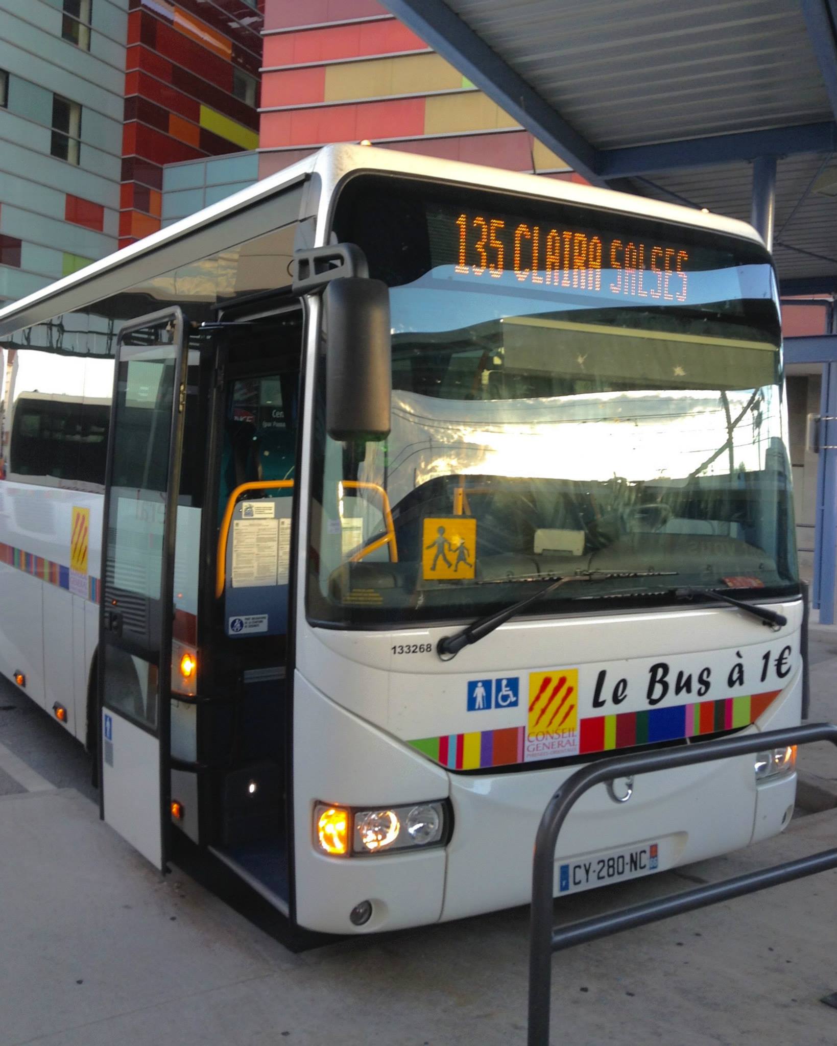
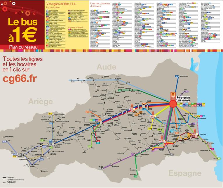
One of the biggest bonuses with living in Argelès-sur-Mer within the Pyrénées-Orientales Department has been Le Bus à 1€ (the €1 Bus), a public transportation system providing bus service throughout the department with dozens of bus routes to scores of cities. This is an amazingly useful and economical way for Tracy and I to travel since we have elected not to buy a car.
Our transportation for the day.
With a €1 Bus stop 100 yards from our front door, it is actually more convenient for us to take the €1 Bus to Perpignan to go to the large supermarket shopping there than to walk to the smaller supermarket that is in Argelès. The current bus schedule list 19 buses a day from Argelès to Perpignan, Monday through Saturday, starting at 6:50 am until 8:40 pm. There is a reduced bus schedule on Sundays. In July and August there are additional routes during the summer season connecting the small beach towns along the Côte Vermeille. Additionally there is an expanded schedules for regular routes during these peak summer months.
1€ Bus Schedules
The €1 Bus service is provided by the Conseil Général des Pyrénées-Orientales, an elected board of 31 Conseillers Généraux (one for each of the 31 Cantons of the Pyrénées-Orientales) and a Chairman. Members of the Conseiller Général are elected for a 6 year term. The Conseil Général decides public policy at the department level similar to the role and responsibilities of a county commission in the United States.
1€ Bus Map
For the price of a single Euro each (currently about $1.11), we can reach nearly anywhere in the Pyrénées-Orientales. The tickets also allow transfers for two hours to other bus routes traveling in the same direction within the €1 Bus system. That means we can take the bus from Argelès to Perpignan for €1, do some shopping, get on a different bus still outbound within the two-hour transfer time limit, and go to Prade for lunch. A return ticket for €1 each will bring us back to Argelès. A traveler would spend more on gasoline than the €2 cost of a round-trip on the bus. (Currently gasoline costs about €1.37 a liter, about $1.50. There are 3.8 liters to a gallon, so gasoline would cost about $5.70 a gallon.)
1€ Bus Tickets
The buses are clean, modern, and comfortable motor coaches. They are dog-friendly and Sami the MinPin can travel with us with the use of a travel bag while she is inside the bus. There are overhead racks for backpacks and under-the-bus-carriage storage for large suitcases or even bicycles. There are even several “Réso 66” stops, “Park and Ride” locations where commuters to park their cars for free and let the bus drive them to work or school. The bus drivers are friendly and helpful, but pretty much they exclusively speak French (if the drivers do speak a second language it’s most probably Spanish or Catalan.) But between our very basic French language skills, pointing at the stop we want on the map, or showing the driver a promotional brochure for a tourist sight, we have not had any problem communicating. (And there is always the red “Stop” button to indicate that you want off the bus.)
€1 Bus Interior
Tracy and I have been making great use of the €1 Bus for our Micro-Adventures. With just €4, a camera, a bottle of water, an inquisitive MinPin, and a picnic lunch, we have an entire day’s entertainment exploring in the Pyrénées-Orientales.
Tracy enjoying one of our Micro-Adventures at Les Orgues d’Ille-sur-Têt, which we reached by the €1 Bus
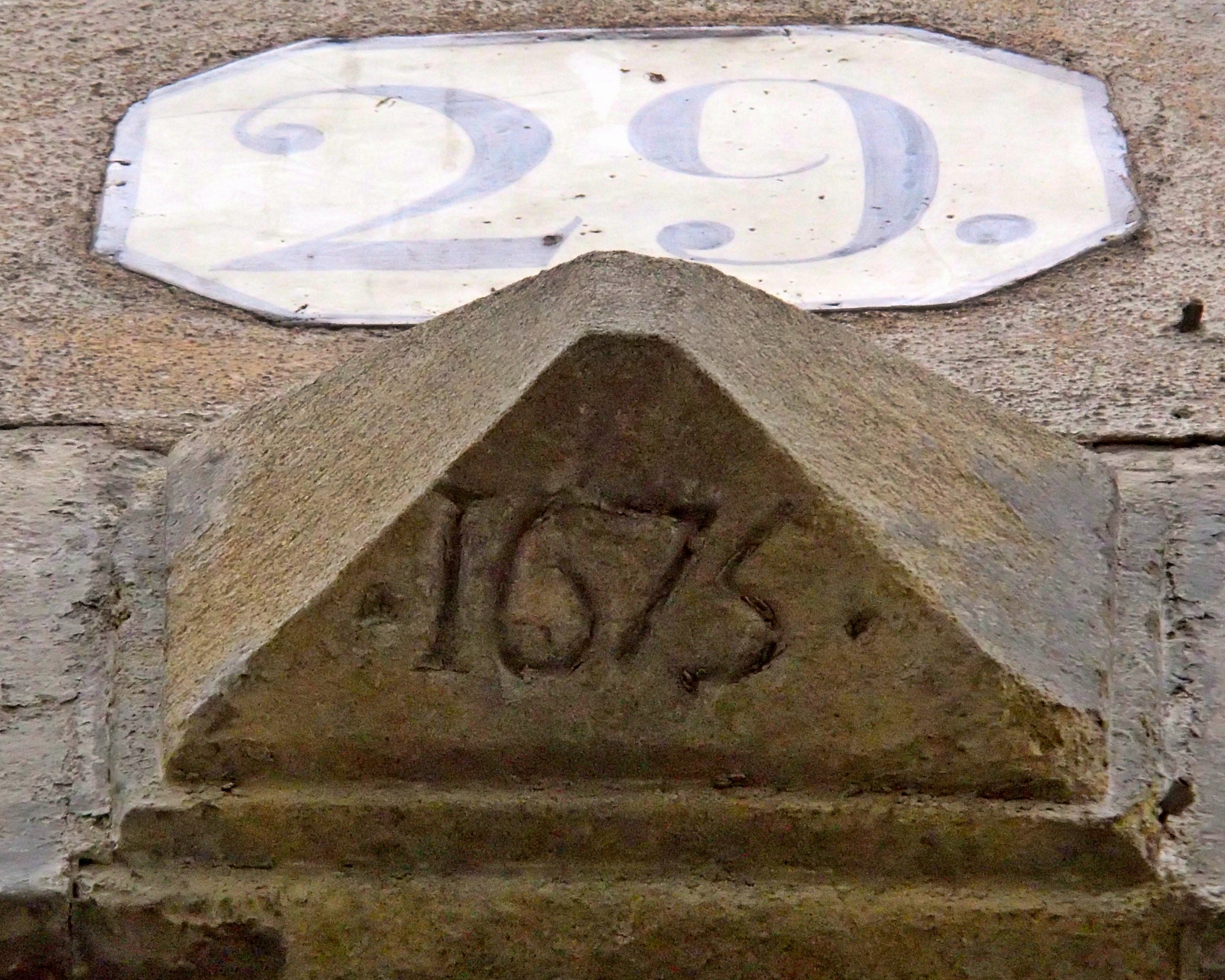
I came across a photo today. One I took over two years ago while Alan and I were out walking with Kiara one evening. The weather had been so especially nice that day. As we headed toward the dog-friendly park on our side of the Aude River, we noticed a keystone with a date on the building across the street from us.
A keystone with the date “1675” on a building in our former neighborhood on the Rue Du Pont Vieux in Carcassonne.
Our landlord at the time, Jason Carr, — an expat from Great Britain — told us that he isn’t sure exactly when the building we lived in was built due to lack of record keeping and from different armies burning the area to the ground a couple of times in the ancient past. He found a few interesting things while renovating, but the exact date is lost in history. The neighborhood dates to the late 17th century, which is interesting enough.
We found the date fascinating. I remember we talked about it while we watched Kiara running joyfully (and leash-less) through the clover at the park, one of her all-time favorite things.
I find that I am continually amazed at the age of things here in France and usually end up mulling over dates like 1776 to put things into perspective. And to think there was a time that I thought a five-year-old car was old!
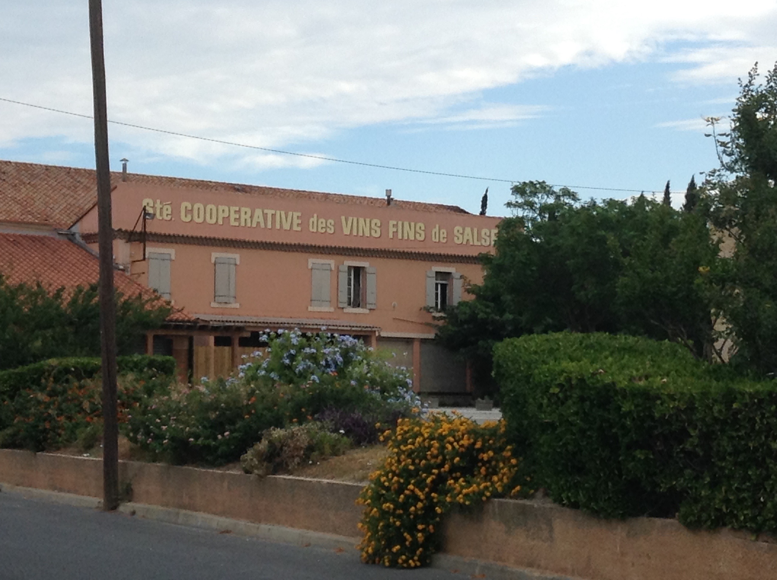
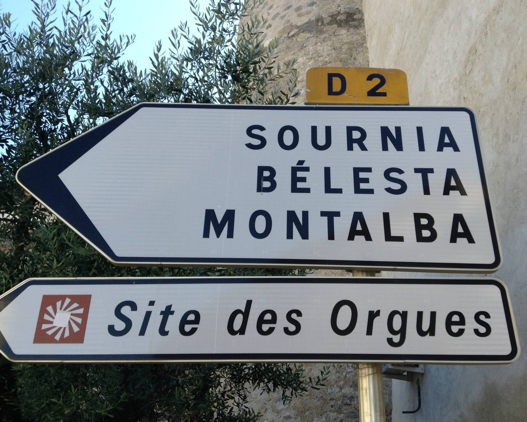
Have you ever noticed that sometimes distances on a map can be very deceiving? This happened to Alan and I on Wednesday when we headed out for Salses-le-Chateau north of Perpignan to visit the Forteresse de Salses, a fort built by the King of Aragon, Ferdinand II.
Yea, that guy. You know the one who married Isabella, became the King of Spain, and then hired Columbus to find a faster route for the spice trade in India but and he found North America instead. Cool, huh!?!
Columbus in the court of Ferdinand and Isabella, by Juan Cordero | via Wikimedia CommonsWe looked at the city on Google maps as we often do to get an idea of the city layout to best strategize which bus stop to jump off at to find the tourist office. In Google maps, I swear it seemed like it was a fair distance outside of the city and after all our time with forts and fortified cities we learned that they are always at the top of hill. There was also a set of train tracks showing between the fort and the city but I did not seeing an overpass, not so good.
So planning for a slightly more strenuous day than Monday, we got up early packed a lunch, loaded up our day packs, fed the dog and headed out for our adventure fully expecting a long day of climbing.
We completely lucked into the perfect timing. The 404 bus from Argeles-sur-Mer to Perpignan arrived at 7:25 and the bus for Salses-le-Chateau left at 7:40, so no coffee in Perpignan but no waiting around either. Almost a win-win. Thank goodness I had coffee before we left!
The 135 bus got us to Salses-le-Chateau by 8:30 and we had seen the directional signs for the fort on the way into town. Not wanting to walk along a major highway we were hoping to find a pedestrian option at the tourist office.
Our transportation for the day.
It was market day in Salses-le-Chateau, so we stopped for coffee at a little street cafe (yeah!). Alan walked around the corner and picked up a couple of chocolate croissants. When we finished Alan asked the owner of the cafe for directions to the fort. The guy pointed up the street and said, “not far.”
The Wednesday Market in Salses-le-Chateau.
Still hoping to find the tourist office we wandered through the square across from the bakery where Alan picked up breakfast. The square was where the market was being held and we skirted the outer edges looking for a sign pointing to the tourist office. We found the Mairie and a museum, but both were closed. The readerboard outside the Mairie entrance had a listing for a recent divorce. Small town information!
Mairie and Modern Art Museum in Salses-le-Chateau.
We wandered over to the market, after browsing all 12 vendors at the market (small town), we stopped to take pictures of a cool fountain behind the wine coop vendor. It was red and had a huge lever to pump the water.
Tracy at the red pump fountain.
Still not seeing the tourist office we walked up a little side alley and found the church. it was closed and it appeared there was some property restoration going on. Part of the front wall was knocked out showing the back side of the arched chapels inside. Oh, and another of those cool fountains, a green one.
The church in Salses-le-Chateau.Construction on the church showing the arched chapels within.Alan at the green pump fountain.
Walking back toward the market we decided that if we didn’t see the tourist office we would just start hiking out to the fort. I know I was procrastinating a bit because it was hot and only about 9:30 am.
Another trip through the market and as we approached the red fountain again Alan pointed out the “i” logo used for some of the tourist offices. We knew we were close, but just couldn’t see it. Walking along the backside of the wine coop vendor to reach a walkway to the main street, I turned around to say something to Alan and noticed the “tourist office” sign in the window. We had walked past it twice while looking for it and never realized it was just behind the wine coop vendor.
The tourist office was directly behind the white van.
Some days are challenging even fully caffeinated.
It was closed, so at least we didn’t feel too foolish. Verbally we decided to just hope for the best, and both silently hoping we wouldn’t have to dash between trains to cross the tracks, we headed up the street.
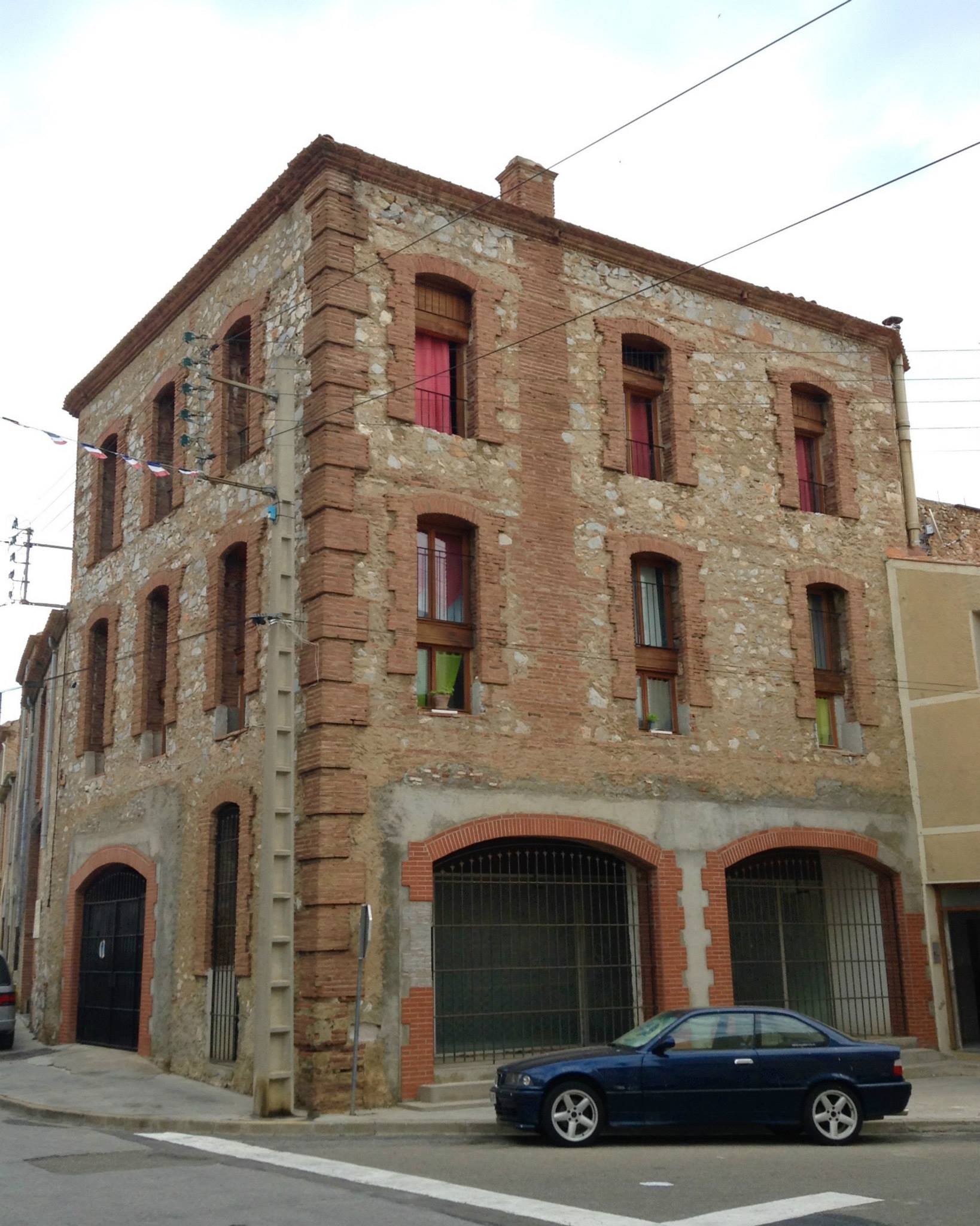
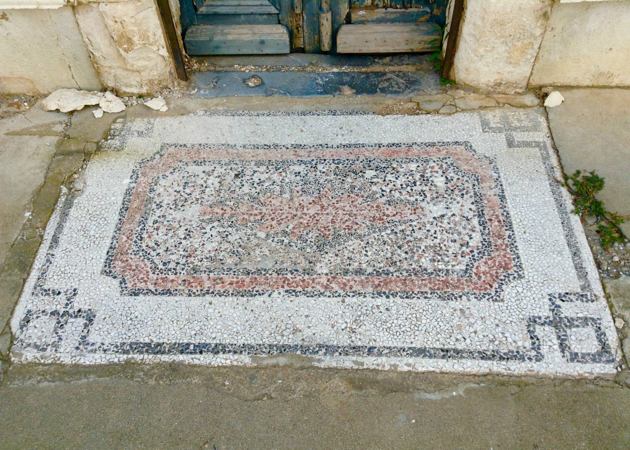
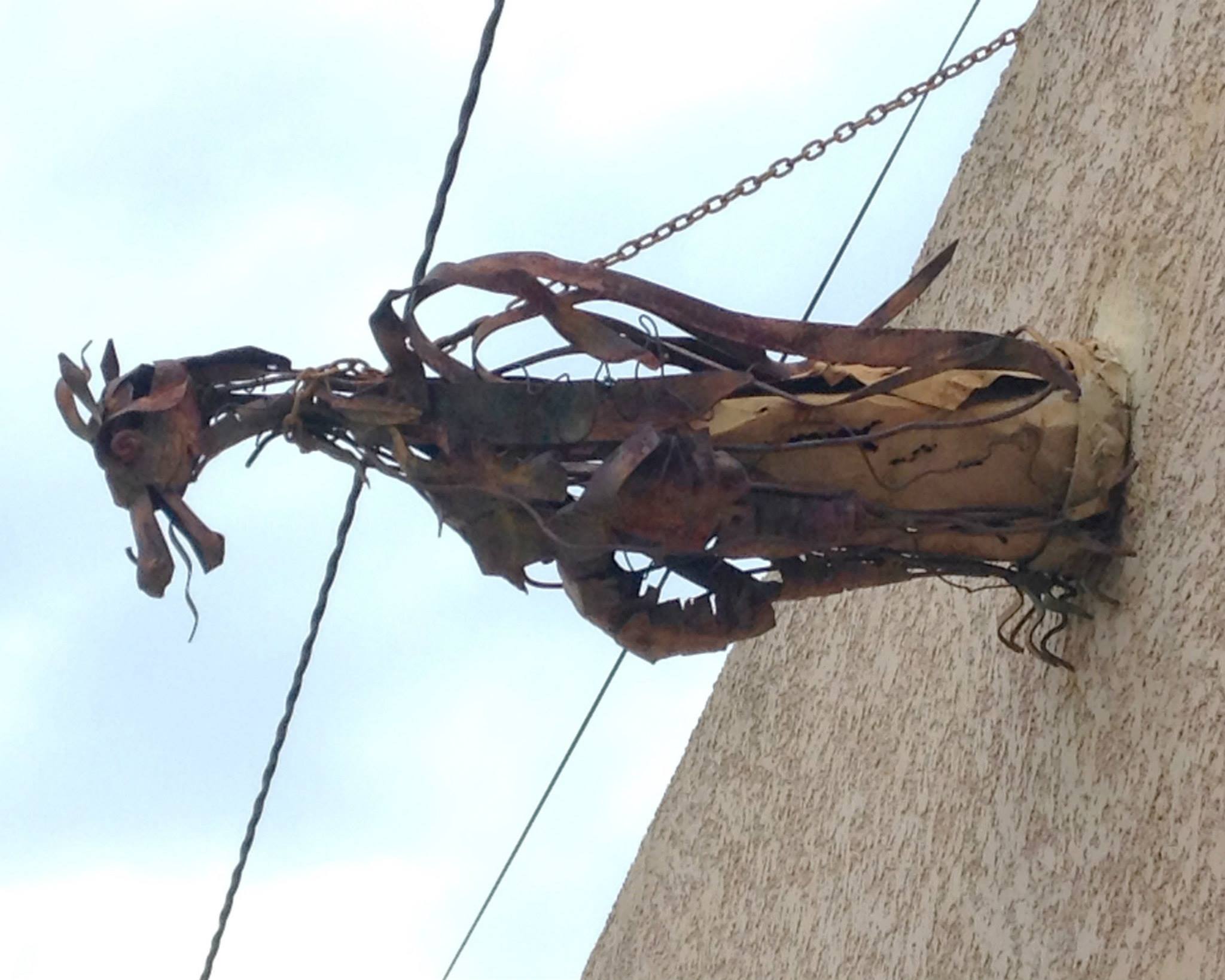
Along the way we saw a couple of interesting buildings. One reminded us both of an old firehouse. One had a unique mosaic welcome mat in the concrete in front of the door. Another had metal gargoyles above the garage.
Building on the main street of Salses-le-Chateau that reminded us of a firehouse.An old mosaic welcome mat.Sculpted metal gargoyle above a garage on the main street of Salses-le-Chateau.
As we approached the area where we saw the directional sign from the bus, I spotted this:
Signage for the pedestrian route to the Forteresse de Salses.
Yep, a dedicated pedestrian path. Some days I’m just grateful that there isn’t anyone around who can tell how foolish I feel.
We walked up the street about 100 meters and saw the wine coop building, pretty little setting. Parking lot was empty because everyone was over at the market!
The wine coop in Salses-le-Chateau.
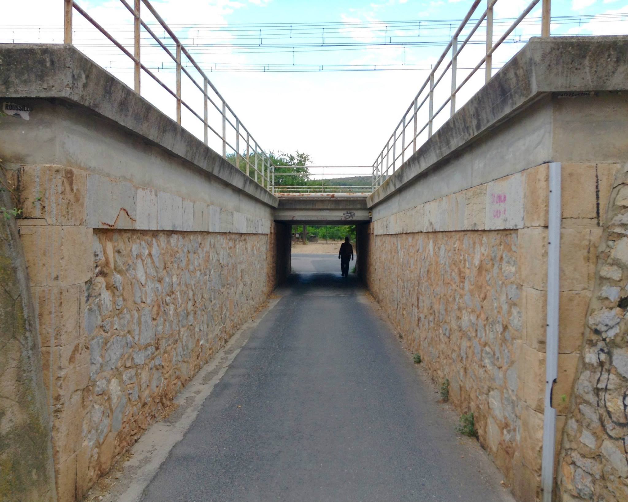
Less than 5 feet past the back corner of the wine coop building was an under pass for the train tracks. Honestly those train tracks looked much further away in Google maps. Good for us!
Pedestrian underpass for train tracks.
On the other side of the train tracks we took a right and realized that we were about 10 yards from the parking lot of the fort. Good thing I packed that lunch in case we spent half the day climbing a hill! That was an exhausting walk all 300 feet of it!
Some days there is just no way to make yourself look smart. Today was that day.
I know I studied at that map. I know that I’m cartographically challenged, but good Lord I just couldn’t help feeling like a complete idiot. Not only was the Forteresse de Salses not far at all from the center of town, the silly thing wasn’t even on a hill . . . it was sunk into the ground!
Model showing the sunken fort.
We arrived early to the Forteresse de Salses and had about 35 minutes before they opened for tourists. We took our time walking around this magnificent structure to photograph it from every angle. As forts go it is rather large and for many tourists it would seem enormous. But, having lived in the shadow of La Cite de Carcassonne it did seem a wee bit smaller!
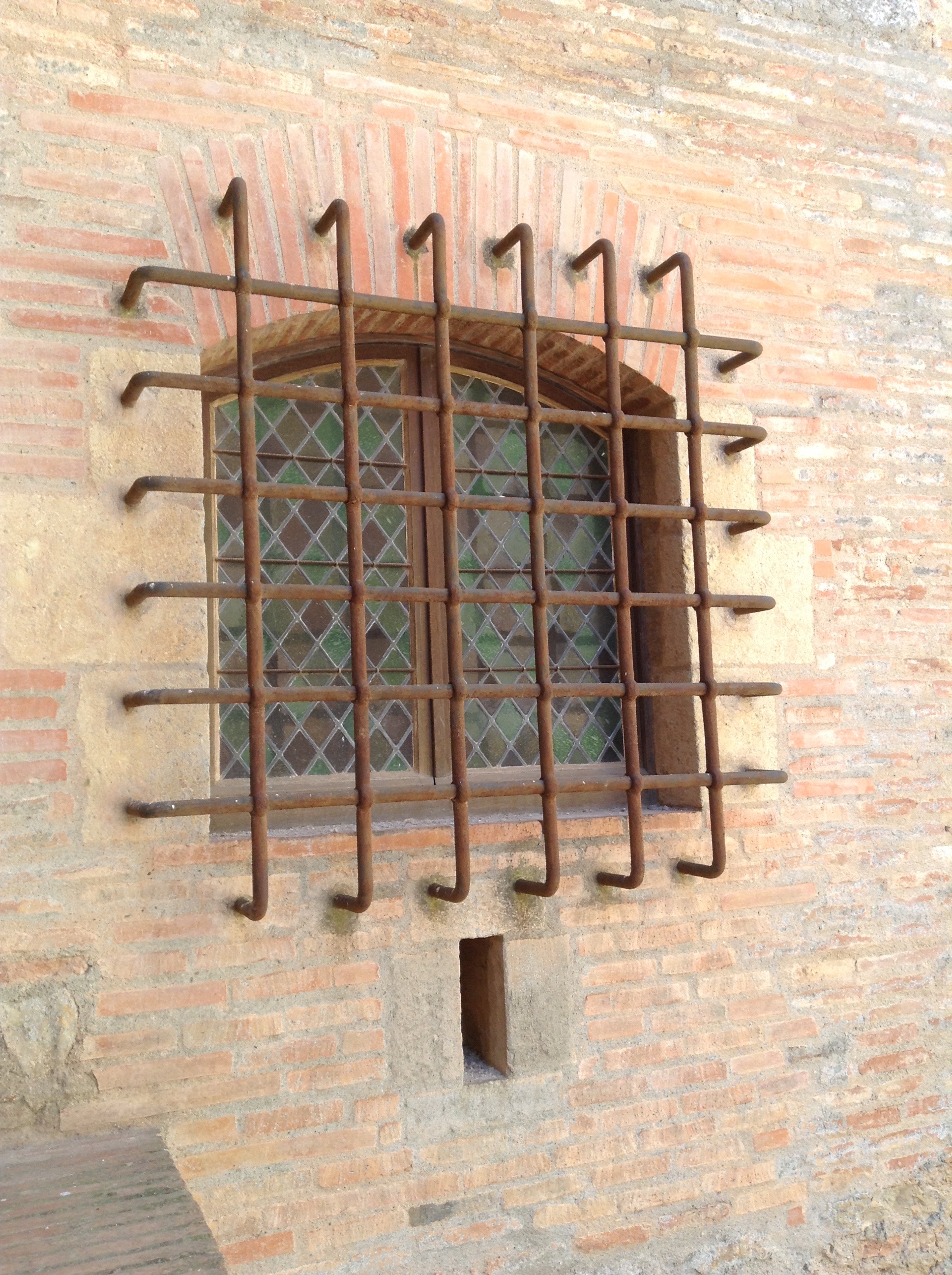
Alan in front of the moat with southeast tower(directly behind him), the northeast tower (middle), and the east bastion (right).
After they opened the doors we purchased our tickets and were rather surprised to be handed an informational pamphlet in English. This doesn’t happen often and we are so grateful when it does. Our French is still rather poor, we can puzzle out most things but having the information in English is just a special bonus.
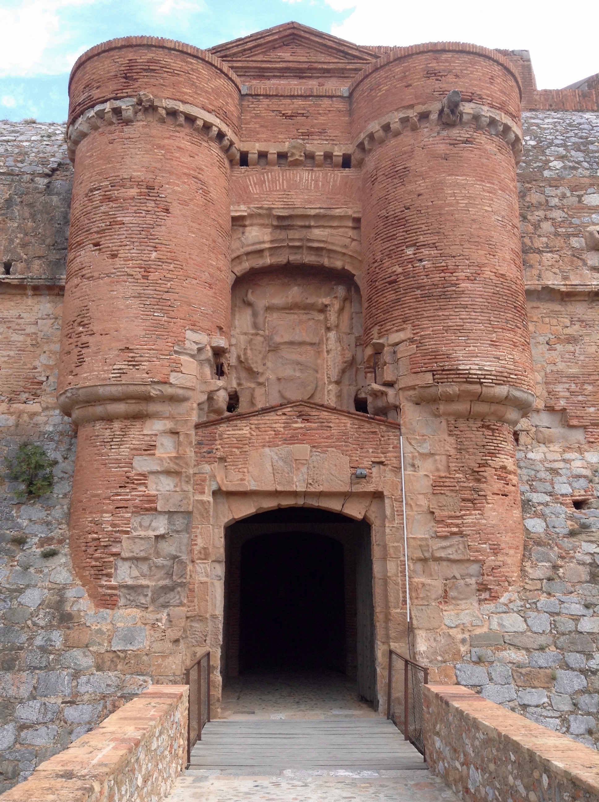
Main entrance after leaving the south bastion, the former drawbridge has been replaced with a more tourist friendly bridge. Between the two towers is the crest of the Kingdom of Aragon, though heavily damaged.
The south and north wings had an audio-visual art installation on lightning in the basement levels where the horses were stabled back in the heyday of the fort. There are ramps leading down to an hard packed earthen floor and the lighting was kept low for the art installation.
The central courtyard had another piece of art but for the life of me I couldn’t figure out what it was supposed to be. Looked like a half-circle bench, but too tall to sit on. No clue what it was supposed to represent. Nearby was the original well for the fort.
Tracy walking over to see the well in the center of the courtyard.
We took a look through the accessible areas of the south, east and north wings. They included stables in the basements of all three wings — two of which had the art installation; — barracks in the south and north wings — at one time there were three floors of barracks in each wing but time had reduced them to just one with a really high roof; — there was a museum in the southeast tower filled with models, a wood boat, information panels, about 7 window displays showing artifacts recovered at the site; and a children’s classroom that was full of kids.
Alan standing behind the model of the Forteresse de Salses in the museum.
The northeast tower housed the chapel with a huge altar facade behind which was a staircase leading down to three small chapels and a well.
Alan standing in front of the alter and huge facade in the chapel.
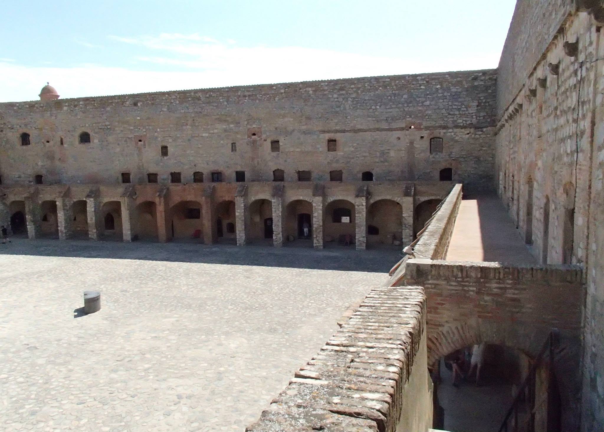
All three wings had arcaded porticos which offered plenty of shade and a few places to sit down. Above the south wing via a set of stairs was access to the ramparts for all three wings, but it isn’t accessible to tourists. From the landing at the top of the stairs there is a fantastic view of the courtyard, the inner moat and the interior rampart that was never completed.
The east side of the courtyard.The west side of the courtyard.
When we finished touring the first three wings we grabbed a seat at one of the picnic tables outside of the south wing and ate lunch. A couple of wraps with ham, mimoulette cheese, and lettuce on corn tortillas, chips, and green grapes the size of small plums.
Saving the best for last, we headed to the inner keep area between the unfinished rampart and the entire west wing that also included part of the north wing, south wing and both the northwest and southwest towers. The southwest tower was specifically placed to provide access to the artesian well which provided water for the entire fort, including the kitchen, the boulangerie (bakery) and what looked to be a bathing room with two stone tubs. The area in front of the Chamber des Vannes was so cool and ventilated that it was like standing in front of an air conditioner!
The stone bathtub in the Chamber des Vannes.
In the center of the west wing was the keep, a seven story building that housed the dungeon, food stores, kitchen staff, and artillery with access to the roof for guard duty. To the left of the keep was the shop, to the right a huge boulangerie (bakery) with hundreds of hand-sized terra cotta balls used to bake bread on. There were six fireplaces, three of which were along the north side of the room above a huge stone table.
Bread was baked by heating the terra cotta balls and laying the bread dough on top.
Built into the ground level of the interior rampart was the kitchen — with running water and a stone sink and the largest fireplace I’ve ever seen, you could roast an entire cow inside and still have room. Next to that was the barn for horses and dairy cows.
Alan standing beside the huge fireplace in the kitchen.
The western side of the south wing that was part of the inner keep had a small residence for the governor and his family. These were the only windows with glass. Diamond shaped stained glass windows covered the first two floors of the residence.
The barred, stained glass window of the governor’s residence in the southwest corner of the inner keep.
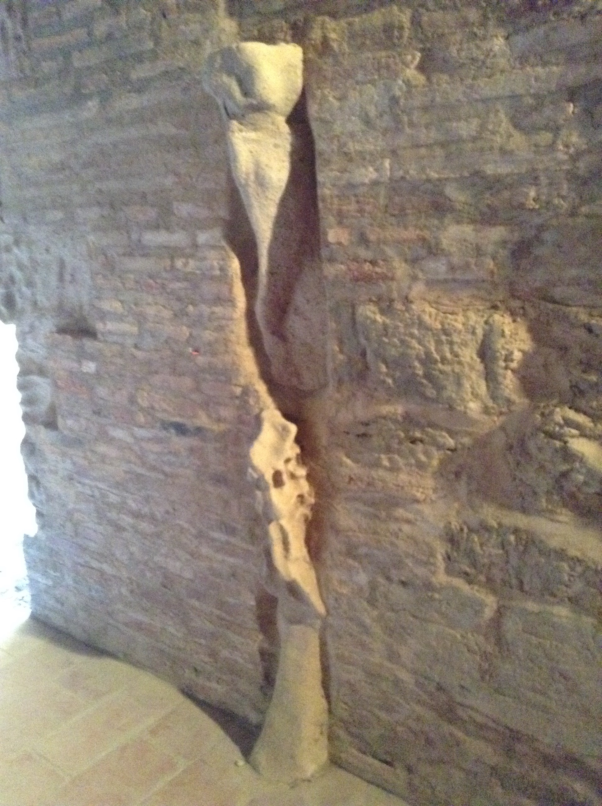
The western side of the north wing that was part of the inner keep was one large room with a small room at the west wall with a small door and a small pass-through window, originally I thought it might be a jail cell but we read in the history pamphlet that the dungeon was in the keep. So we are still clueless as to what was kept in there. The only thing of interest other than the weird tiny room was the remnants of a decorative piece in the center of the wall facing the inner keep.
The remnants of decorative detail in the northwest corridor of the inner keep.
Entrance into the inner keep was made through another huge gate in the wall of the unfinished rampart. I read later that this was the last line of defense if the fort were ever taken. All of the food and cooking areas are included inside as well as that hidden well in the southwest tower. So if the fort was taken by enemies the soldiers and others could barricade themselves in the inner keep where they might be able to hold off invaders. There was also an underground tunnel from the northwest tower to the northwest bastion, so I assume there may have been an escape route planned from there as well.
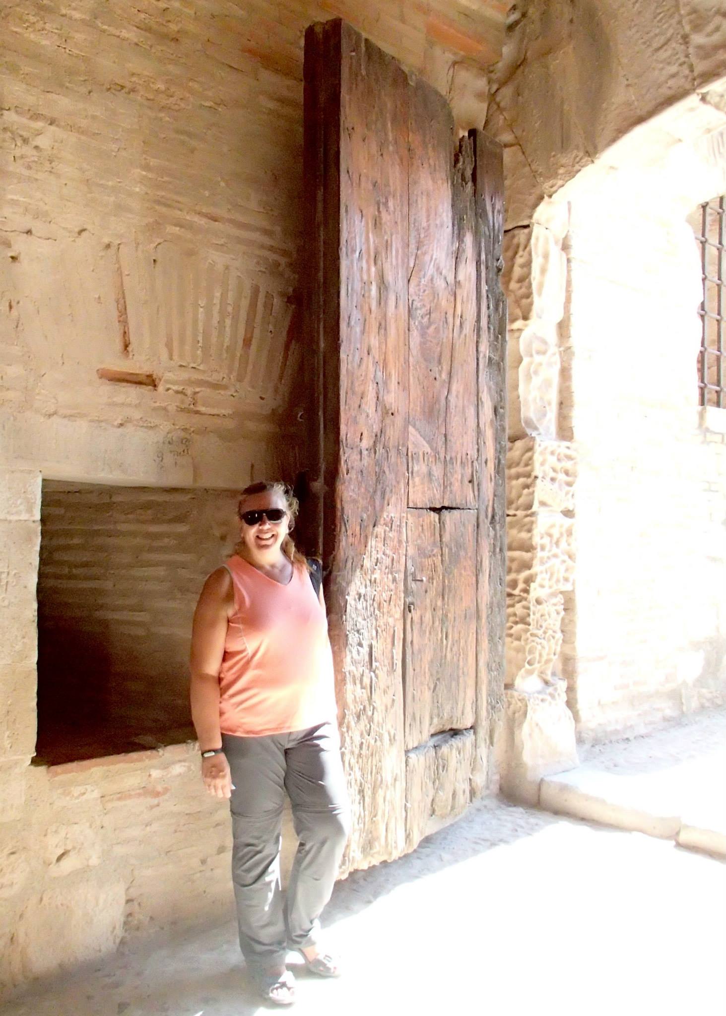
Tracy standing by gate to inner keep at the Forteresse de Salses.
Once we finished touring around, we headed back to the gift shop where I picked up a bottle of lavender syrup. The restrooms were in the basement and were added into an existing area so it did seem a bit weird to see huge rocks behind you while washing your hands!
The restroom in the gift shop.
The Forteresse de Salses is definitely worth the time to visit. For a more detailed account of the building see our post Forteresse de Salses, history and extras.
A new phrase that has gained popularity with the husband: Micro-adventure. It’s the perfect word for our little day trips to see the cities and sights here in the Pyrenees-Orientales region of France.
As we have been traveling to nearby cities via the 1 Euro bus system, we try to make our first stop the Office de Tourisme or rather coffee then the tourist office. Picking up a town map and browsing through the collection of brochures for other places of interest. Alan usually handles getting a copy of the map, I do the browsing. After returning home we look through all the new offerings and select a Top 5 list. Les Orgues d’Ille-sur-Têt was #1 on our Top 5. It is a natural geological sight, very reminiscent of Bryce Canyon, just much smaller.
So Monday morning arrives way too early, our day was meant to start early but a dying battery in the smoke alarm decided to go off at 4 am. Then Sami decided that she was done sleeping and we all needed to be up and someone should take her for a walk. I let Alan take her while I stayed home with a cup of coffee,. Shameful I know, but I drink coffee everyday and he doesn’t. So the alarm for 5:30 got shut off and we started the day a bit earlier than planned. Why is it that batteries in smoke alarms only run out in the middle of the night? Have you ever had one signal a replacement during the day? Neither of us has, it seems that only in the wee hours of the morning do smoke alarms need new batteries . . . hmmm, like their little, plastic lives have no meaning unless something has been tested . . . like your heart rate recovery time.
Well, we weren’t late for the bus. After arriving in Perpignan we talked to the gentleman at the bus kiosk, asking him for the route maps for the lines that went to Ille-sur-Têt. He handed us brochures for all the buses that service that area. We walked over to our favorite coffee shop across from the train station and while waiting for our coffee and chocolate croissant, we found that the 200 bus would be the first to head towards our destination. It gave us about 40 minutes to enjoy our breakfast. Perfect! If you transfer within two hours of your first ticket purchase you do not have to pay a second time.
Ille-sur-Têt was reachable via the 200 bus but is also serviced by the 220, 240 and 260 lines. We had the brochure for Les Orgues in hand and showed it to the driver. 25 minutes later, when we reached the correct stop, he gave us the thumbs-up and we were on our way. Ever so helpful, he even explained how to get to Les Orgues, but our French isn’t quite good enough to understand all the directions. We found the Office de Tourisme instead and asked for directions. The lady there was very helpful and in a matter of minutes we were on the right track.
On our return from Les Orgues, we found a little side street that led to St. Etienne’s, the Mairie (town hall) and a few interesting corner gardens, one named for Jean of Arc and another for St. James. When we found our way back to the main street we stopped at the Bar Le Nationale Brasserie for lunch. We ordered beer. When we finished those we ordered burgers. A “carafe d’eau” (bottle of tap water), which is normally refrigerated and refreshingly cool without having to pay bottled water prices, still wasn’t quite enough to quench our thirst. It was 36 degrees Celsius, approx. 98 degrees Farenheit. A very warm day.
After lunch, we wandered about town until we found the Hospice d’Illa. Wandering through and seeing some of the very nice pieces in their permanent collection as well as some very nice Baroque works of art. They also had a display in the lower chapel galleries of some of the interesting stained glass windows from around the area.
When we finished all our “must see” items, we wandered through town a bit more and spotted some beautiful old buildings, interesting alleys and walkways. We both really enjoy wandering through a former walled city that has been around for centuries. Though the town updates and changes, you often find little pockets here and there of original cobblestone, or gallery overhangs, or covered entrances that still bear the original wood beams or remnants of the original paint, sometimes an old sign or an entire side of a building that has old advertising.
It’s the little things that make our micro-adventures so enjoyable. We both love architecture, sacred or otherwise. We both have a sense of wonder at the way people in Europe live with their history. If you just take the time to wander without a destination in mind, you find the most amazing, little surprises!
After we wandered back to the main street and checked the schedule on the bus stop, we had about 40 minutes to kill before the next bus. We headed over to a different cafe and had another cold drink. While we were sitting there, we saw four different tractors go by. Life in a small town! Ille-sur-Têt is a small town of around 5,000 people but they sure do have a lot of lovely history.
Interesting detail in a wall surrounding someone’s property inside the ramparts.
Time and patience. This grape vine has been trained to act as a tree providing shade above the doorway on a narrow street.
Someone added Egyptian detail to the bars over their window.
Alan cooling off after hiking in the heat.
One of the many tractors we saw on the main street. Love the turn signal.
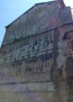
Old advertising on the side of a building.
Street sign on a rock wall.
Beautiful contrast of color.
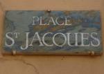
The little corner garden named for St. James, this sign is in Catalan.
The little corner garden named for St. James, this sign is in French.
The town square where the market is held.
The street opposite the grounds of the Hospice d’Illa.
We have found that most of the staff in the tourist offices speak at least a little bit of English. Usually enough to get a map or directions. Ille-sur-Têt’s tourist office didn’t have printed city maps, but rather a large laminated map. When we asked for a map and directions to Les Orgues, the staff person pointed out the route and we jotted down the names of the streets. She said, “Just follow the signs, it is not far.”
Directional sign for Les Orgues
And it really wasn’t. 2 kilometers from the bus stop, about 20 minutes of walking and we were at the Visitor’s Center for Les Orgues d’Ille-sur-Têt. Most of the walk was on wide sidewalks. There were a few places with little room for pedestrians but drivers in our region are used to pedestrians, cyclists, runners so they just slow down and move over . . . well sometimes they slow down!
Alan on the walk out to Les Orgues
We went into the Les Orgues Visitor’s Center and while Alan purchased the entrance tickets (5 Euro/each) I browsed through the brochures they had laid out. Oddly they had more than the tourist office in town and I picked up several I hadn’t seen before.
Access to the site was gained by a short walk (800 meters) on a dirt path with an interpretive trail. The Visitor’s Center had guide books that included information about the flora and fauna, waterways and flooding, etc. We dutifully stopped at each of the numbered markers and read the information in the mini guide book, which was in English.
One of the interpretive trail markers.
We were in the Têt Valley, an area called “Ribêral” meaning “river area” or “born from rivers.” In the distance is the Canigou Massif (2,784 meters) topped by the “dog’s tooth peak.” It is the last high summit of the Eastern Pyrenees, an important symbol for the Catalan people.
Earlier the area had another name, “El Val del Infern” (Hell’s Valley). The landscape was very dry. Along the interpretive path we read about the Mediterranean farming for this small area which mainly consist of vineyards, olive, almond and fig trees. A startling contrast from the rest of the Têt Valley which is well irrigated and known for its peach production. The peaches have vivid red coloring due to the reflection of the sun on the sand.
Part of the interpretive trail, an olive grove shows the types of trees that could grow here before the area was irrigated.
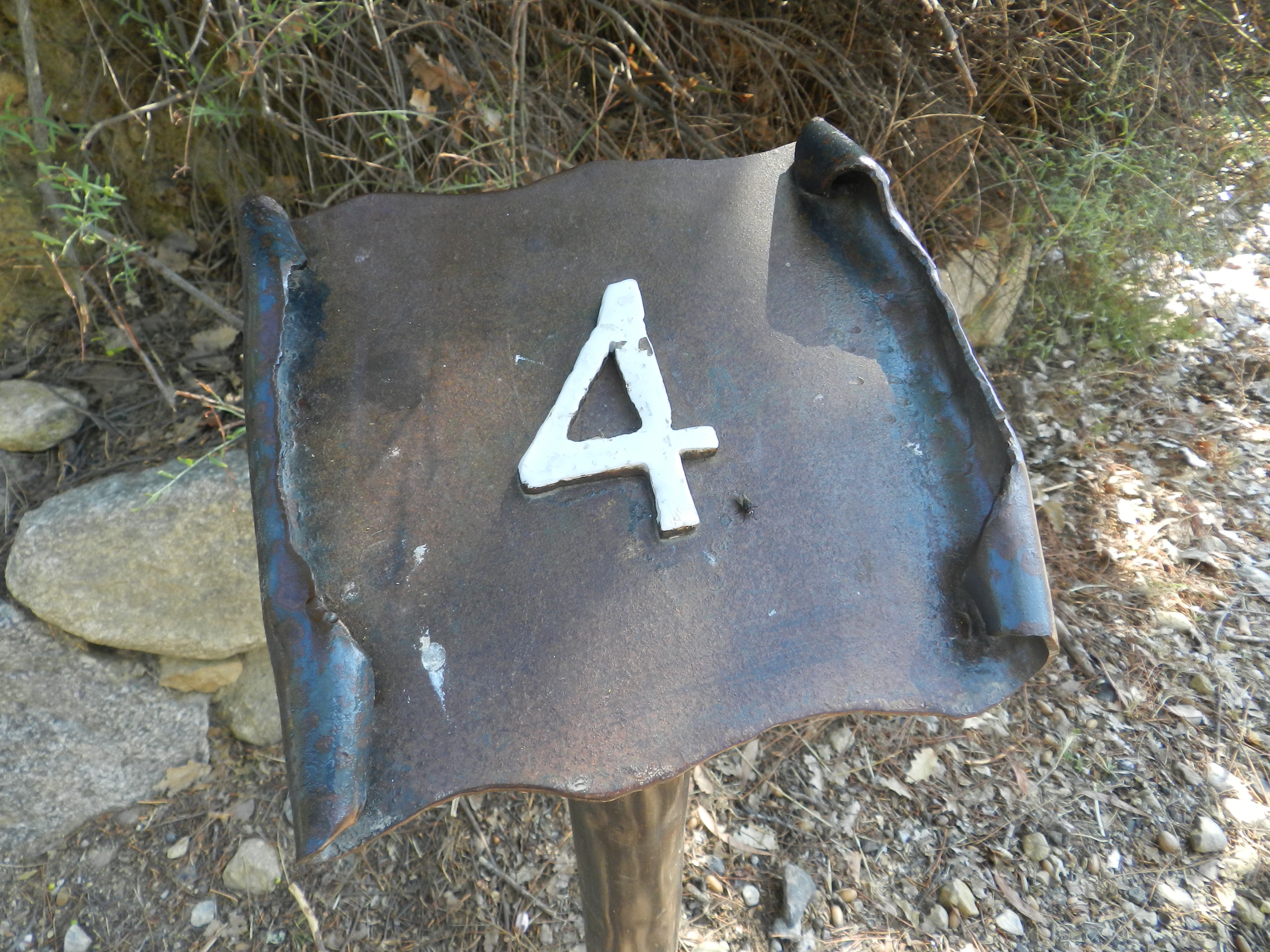
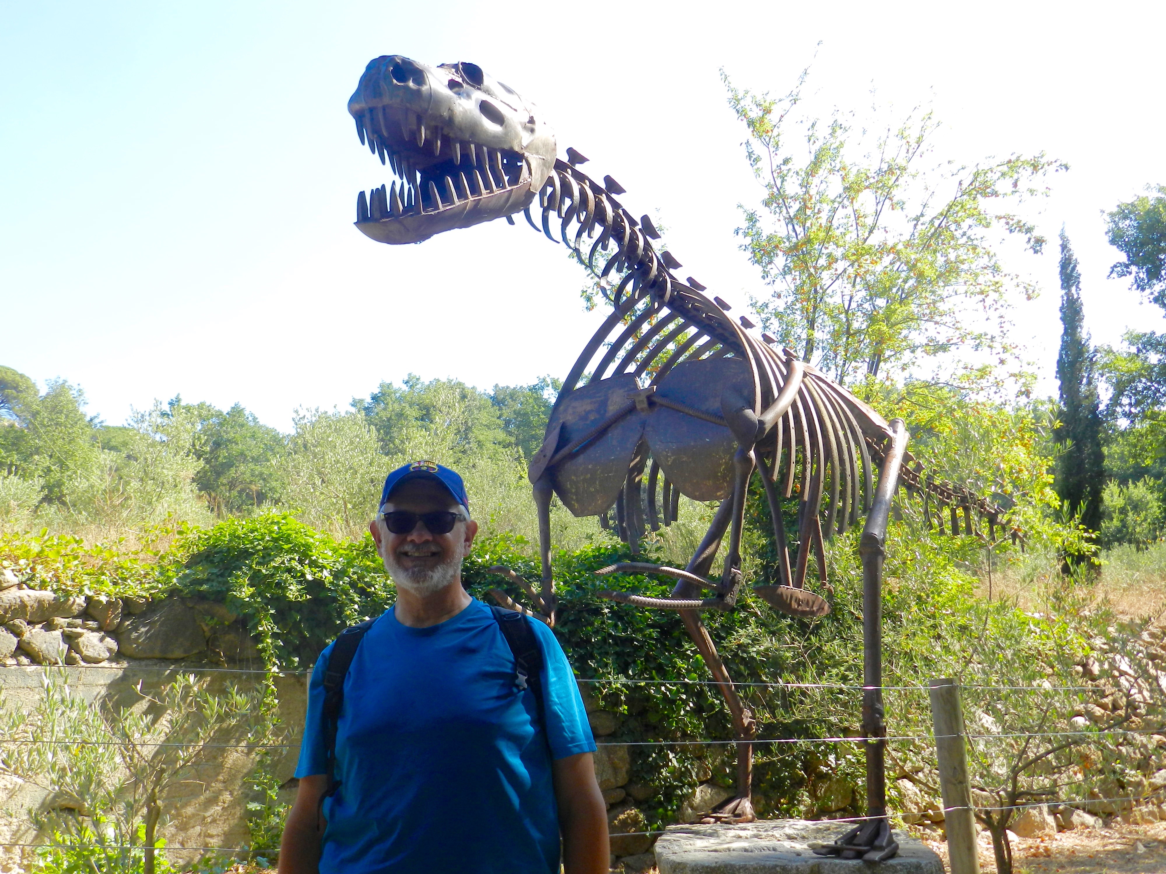
Right after marker 2 was a sculpture garden. The sculptures were made from a lot of different things, found items in most cases. The small statue of four girls dancing were made from old axe heads. My favorite was the T-Rex skeleton. Much larger than the rest and almost hidden around a bend in the path, it drew smiles from everyone passing by.
Alan and Rex
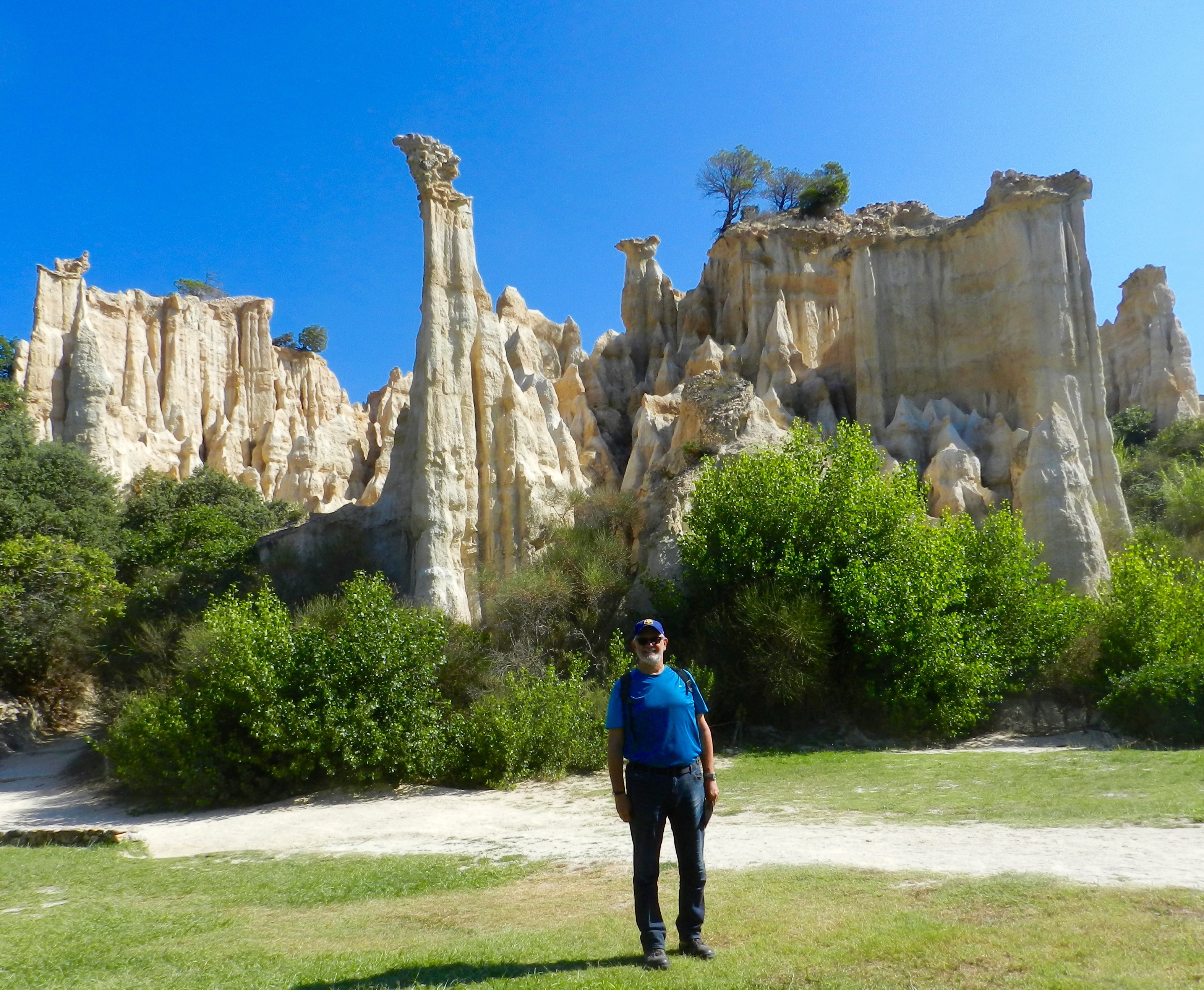
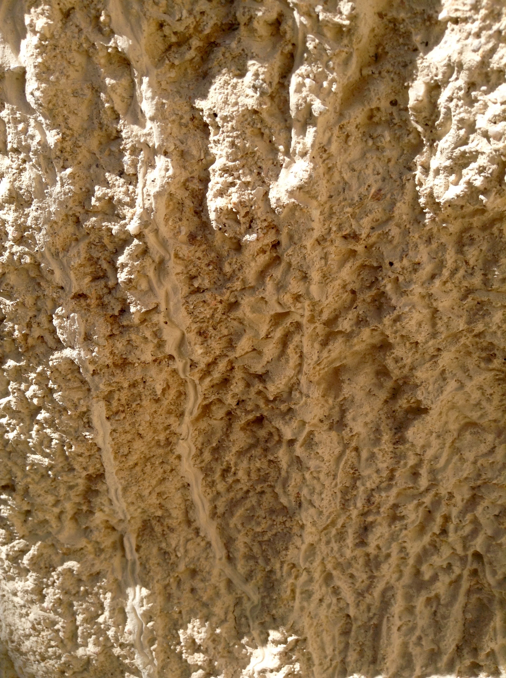
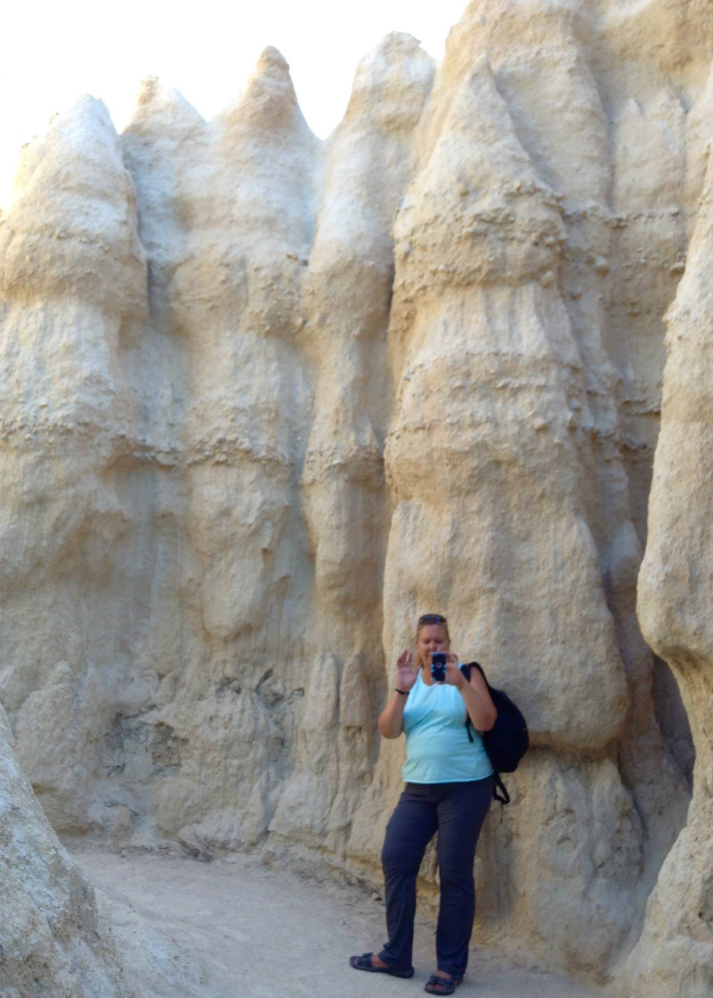
Upon reaching the entrance to Les Orgues, we handed our tickets to the young lady at the kiosk and entered the world of fairy chimneys. The site opens up like an amphitheater with walls of gigantic columns 10 to 12 meters high (30 to 40 feet).
Alan with the “fairy chimneys” in the background.
It takes about an hour or so to walk through the small park, including time to take photos. The area is beautiful with white and tan columns topped by layers of rock and in some cases trees and shrubs. The columns look like chess pieces or organ pipes or chimneys. The formations are called by many different things, chimney rocks, fairy chimneys, organ pipes, hoodoos. Since individual formations had no official names we were making them up, such as the “amphitheater” or “chess pieces.”
The “chess pieces.”
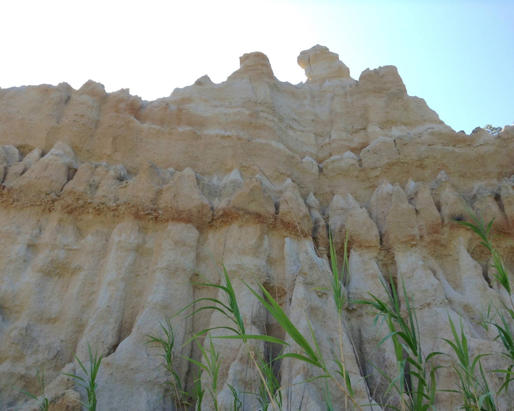
The guide book stated that the area is in a constant state of change. The sandy rock columns change with each drop of rain as they have for the last five million years. Areas like Les Orgues are scattered around the Têt Valley but nowhere else are the results quite as spectacular. However the name Les Orgues means The Organs a name which is typically used to designate basalt streams that have solidified into long pipes or columns. This particular area is not volcanic in origin, just named before the term was designated for basalt columns.
Close up of labyrinth wall detailing water run-off.
There was also a “Labyrinth” trail (about 100 meters long) that wound up through the ‘chimneys’ to a dead end. The guide book did state that it was one labyrinth that no one would get lost in!
Tracy on the labyrinth trail.Alan walking up through the labyrinth.
We also learned that the area was home to aurochs, cave lions, cave bears and cave hyenas in prehistoric times. No mention of dinosaurs . . . except the metal T-Rex.
I had brought my good Nikon with me, but my batteries died . . . both of them. I think after 4 years they aren’t up to the job anymore or perhaps it was just a bad day for batteries! But we had both brought our iPods, training ourselves to use them for our big hike on the Camino de Santiago coming up in just about five weeks.
Back at the Visitor’s Center we enjoyed the air conditioning inside while purchasing a couple of cold drinks then sat outside on the covered terrace. Once finished, we headed back into town for lunch and visits to the churches in town. St. Etienne was visible from the bridge across the Têt River and Hospice d’Illa is a few blocks away — more about them here.
In the photos you’ll notice strips of color in the columns. The white corresponds to clay, the ochre color to iron oxidation, the brown or grey spots are lichen and moss which will turn green again with enough water.
If you are ever near the area, it is definitely worth a stop. It doesn’t take long to walk out to the site and have a look around, but is definitely a “Do Not Miss” place in this region.


![By Juan Cordero (Own work, ClarkSui, 2013-02-12) [CC BY-SA 3.0 (http://creativecommons.org/licenses/by-sa/3.0)], via Wikimedia Commons](https://an-italian-point-of-view.com/wp-content/uploads/2015/07/1024px-cristobal_colon_en_la_corte_de_los_reyes_catolicos_by_juan_cordero_1850.jpg)