Micro-Adventure: Forteresse de Salses

Have you ever noticed that sometimes distances on a map can be very deceiving? This happened to Alan and I on Wednesday when we headed out for Salses-le-Chateau north of Perpignan to visit the Forteresse de Salses, a fort built by the King of Aragon, Ferdinand II.

Yea, that guy. You know the one who married Isabella, became the King of Spain, and then hired Columbus to find a faster route for the spice trade in India but and he found North America instead. Cool, huh!?!

By Juan Cordero (Own work, ClarkSui, 2013-02-12) [CC BY-SA 3.0 (http://creativecommons.org/licenses/by-sa/3.0)], via Wikimedia Commons
Columbus in the court of Ferdinand and Isabella, by Juan Cordero | via Wikimedia Commons
We looked at the city on Google maps as we often do to get an idea of the city layout to best strategize which bus stop to jump off at to find the tourist office. In Google maps, I swear it seemed like it was a fair distance outside of the city and after all our time with forts and fortified cities we learned that they are always at the top of hill. There was also a set of train tracks showing between the fort and the city but I did not seeing an overpass, not so good.

So planning for a slightly more strenuous day than Monday, we got up early packed a lunch, loaded up our day packs, fed the dog and headed out for our adventure fully expecting a long day of climbing.

We completely lucked into the perfect timing. The 404 bus from Argeles-sur-Mer to Perpignan arrived at 7:25 and the bus for Salses-le-Chateau left at 7:40, so no coffee in Perpignan but no waiting around either. Almost a win-win. Thank goodness I had coffee before we left!

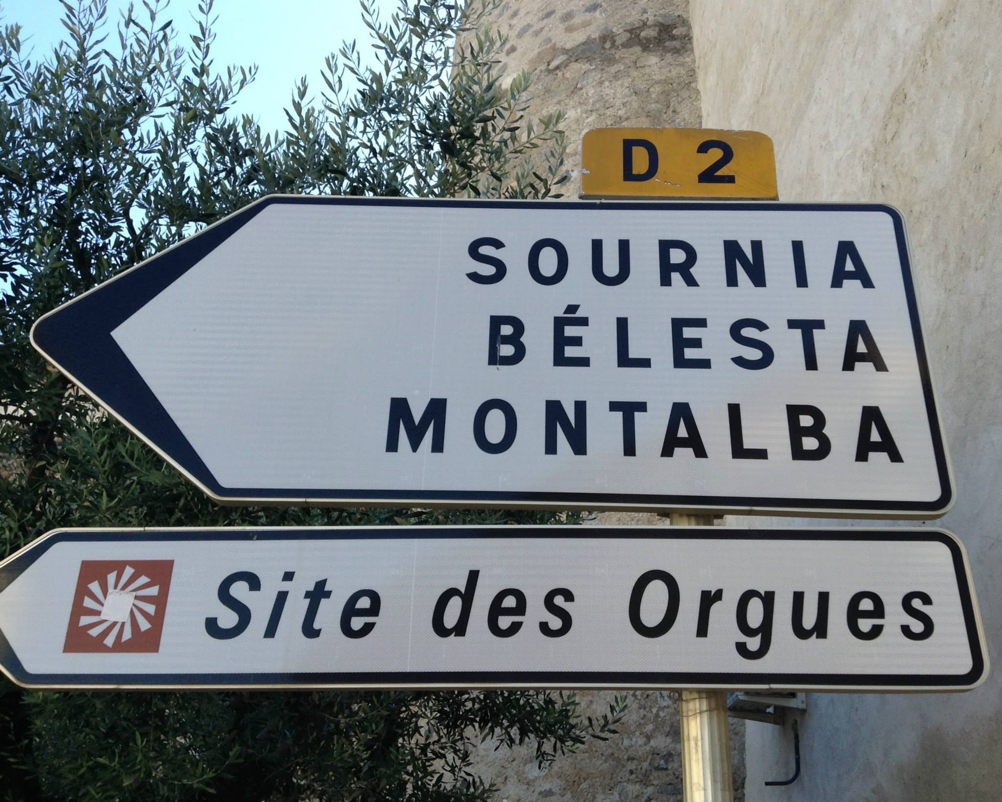
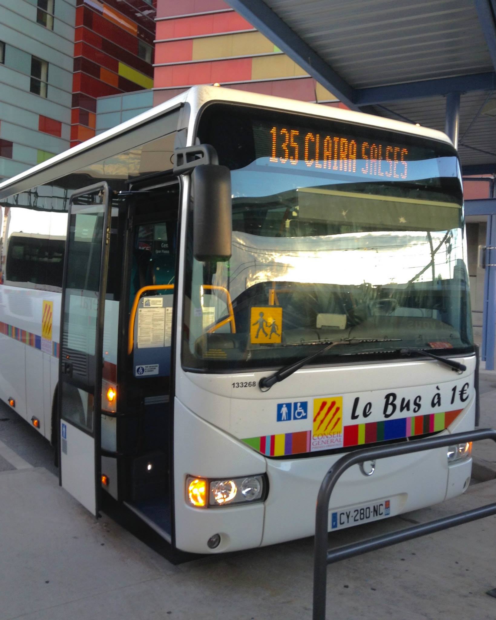
The 135 bus got us to Salses-le-Chateau by 8:30 and we had seen the directional signs for the fort on the way into town. Not wanting to walk along a major highway we were hoping to find a pedestrian option at the tourist office.

Our transportation for the day.

It was market day in Salses-le-Chateau, so we stopped for coffee at a little street cafe (yeah!). Alan walked around the corner and picked up a couple of chocolate croissants. When we finished Alan asked the owner of the cafe for directions to the fort. The guy pointed up the street and said, “not far.”

The Wednesday Market in Salses-les-Chateau.
The Wednesday Market in Salses-le-Chateau.

Still hoping to find the tourist office we wandered through the square across from the bakery where Alan picked up breakfast. The square was where the market was being held and we skirted the outer edges looking for a sign pointing to the tourist office. We found the Mairie and a museum, but both were closed. The readerboard outside the Mairie entrance had a listing for a recent divorce. Small town information!

Mairie and Modern Art Museum in Salses-les-Chateau.
Mairie and Modern Art Museum in Salses-le-Chateau.

We wandered over to the market, after browsing all 12 vendors at the market (small town), we stopped to take pictures of a cool fountain behind the wine coop vendor. It was red and had a huge lever to pump the water.

Tracy at the red pump fountain.

Still not seeing the tourist office we walked up a little side alley and found the church. it was closed and it appeared there was some property restoration going on. Part of the front wall was knocked out showing the back side of the arched chapels inside. Oh, and another of those cool fountains, a green one.

The church in Salses-les-Chateau.
The church in Salses-le-Chateau.
Construction on the church showing the arched chapels within.
Alan at the green pump fountain.

Walking back toward the market we decided that if we didn’t see the tourist office we would just start hiking out to the fort. I know I was procrastinating a bit because it was hot and only about 9:30 am.

Another trip through the market and as we approached the red fountain again Alan pointed out the “i” logo used for some of the tourist offices. We knew we were close, but just couldn’t see it. Walking along the backside of the wine coop vendor to reach a walkway to the main street, I turned around to say something to Alan and noticed the “tourist office” sign in the window. We had walked past it twice while looking for it and never realized it was just behind the wine coop vendor.

The tourist office was directly behind the white van.

Some days are challenging even fully caffeinated.

It was closed, so at least we didn’t feel too foolish. Verbally we decided to just hope for the best, and both silently hoping we wouldn’t have to dash between trains to cross the tracks, we headed up the street.

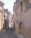
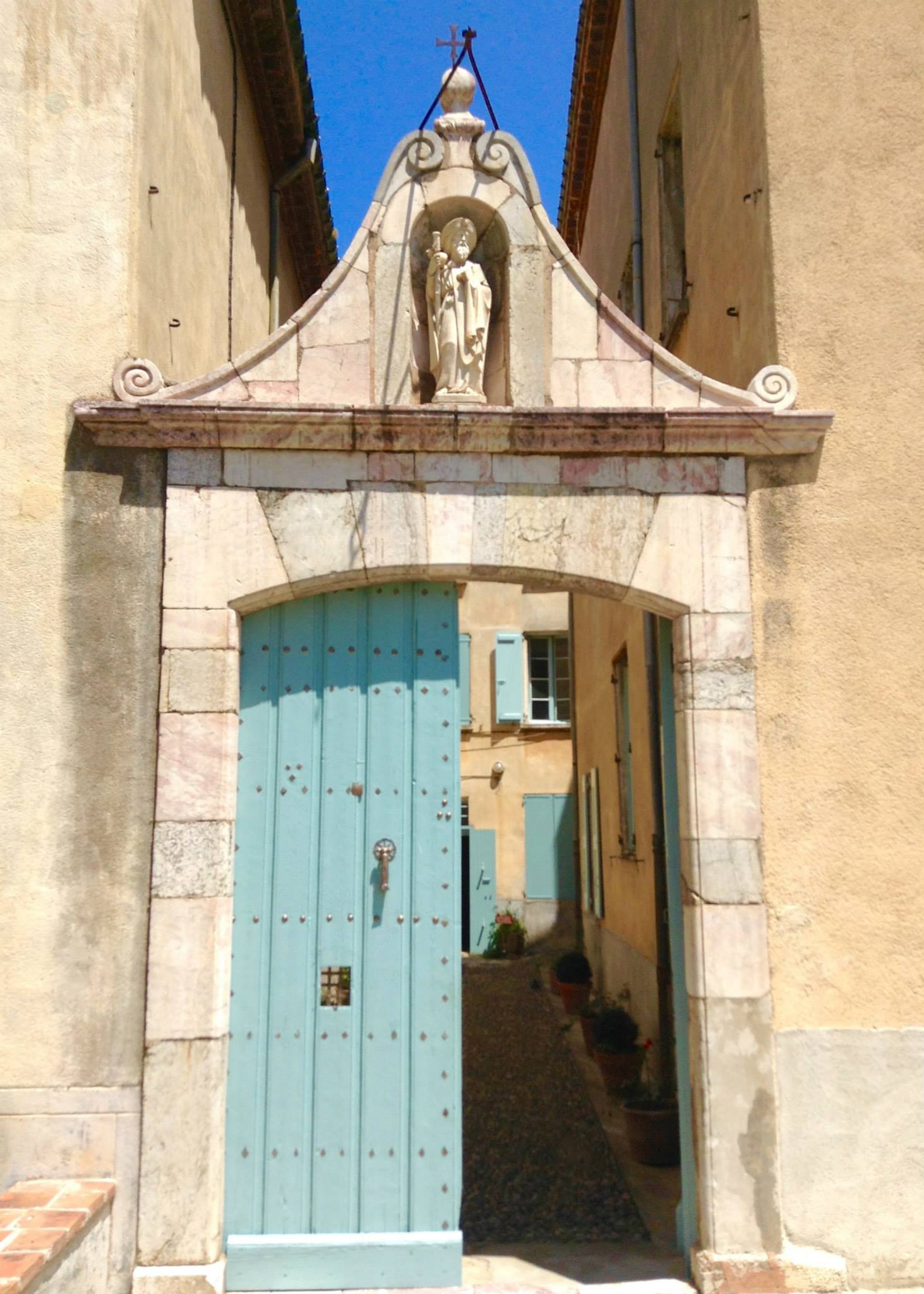
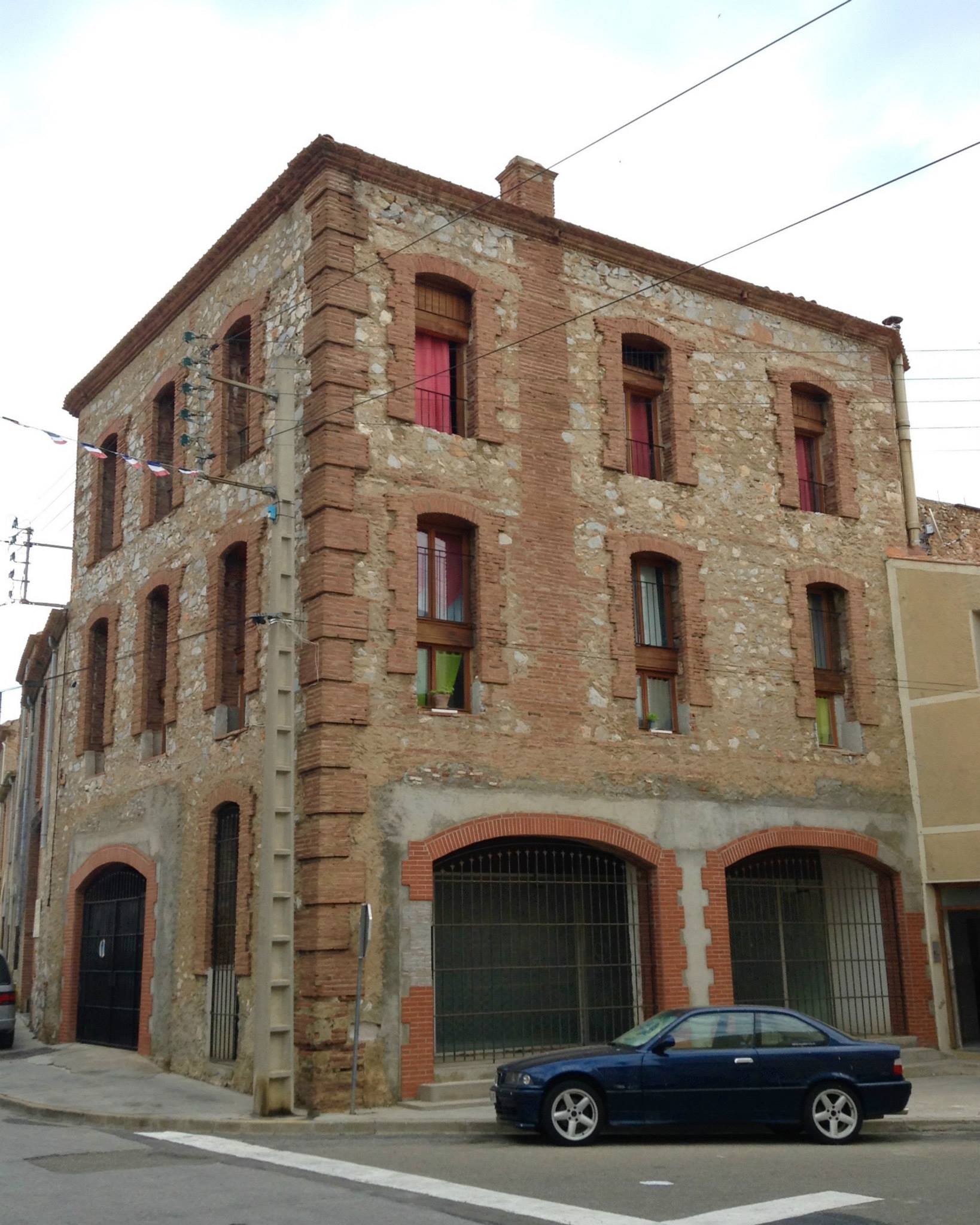
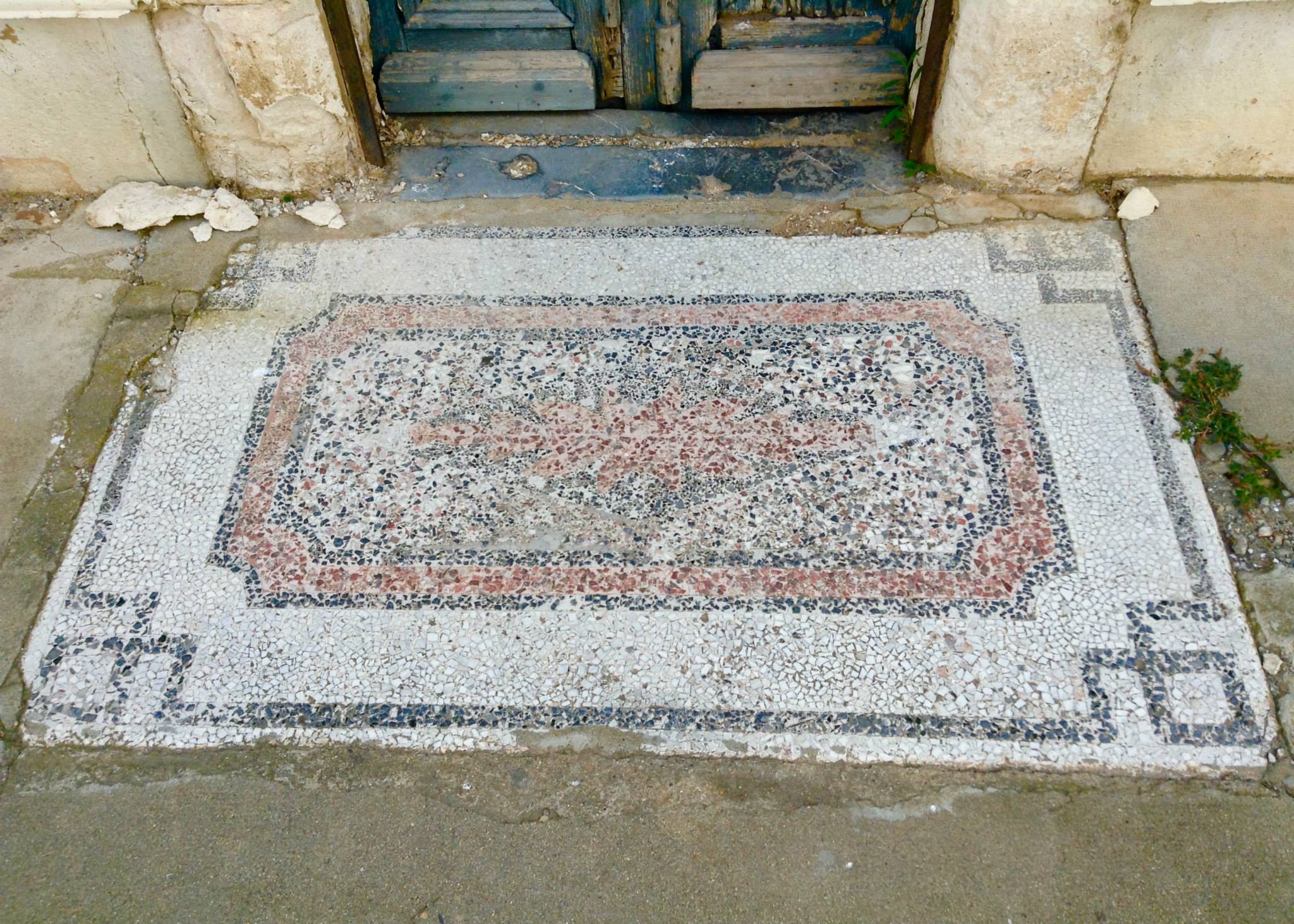
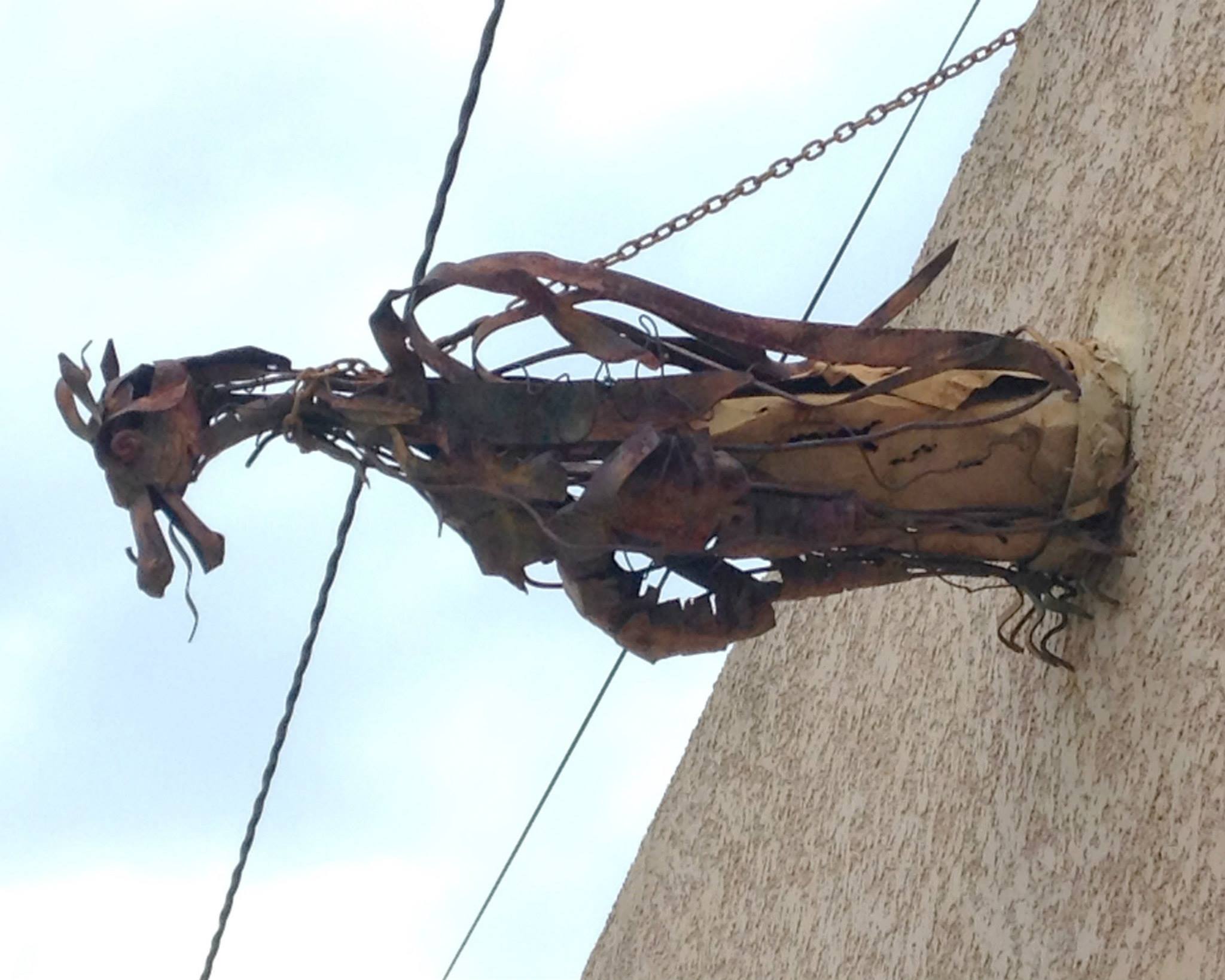
Along the way we saw a couple of interesting buildings. One reminded us both of an old firehouse. One had a unique mosaic welcome mat in the concrete in front of the door. Another had metal gargoyles above the garage.

Building on the main street of Salses-les-Chateau that reminded us of a firehouse.
Building on the main street of Salses-le-Chateau that reminded us of a firehouse.
An old mosaic welcome mat.
Sculpted metal gargoyle above a garage on the main street of Salses-les-Chateau.
Sculpted metal gargoyle above a garage on the main street of Salses-le-Chateau.

As we approached the area where we saw the directional sign from the bus, I spotted this:

Signage for the pedestrian route to the Forteresse de Salses.

Yep, a dedicated pedestrian path. Some days I’m just grateful that there isn’t anyone around who can tell how foolish I feel.

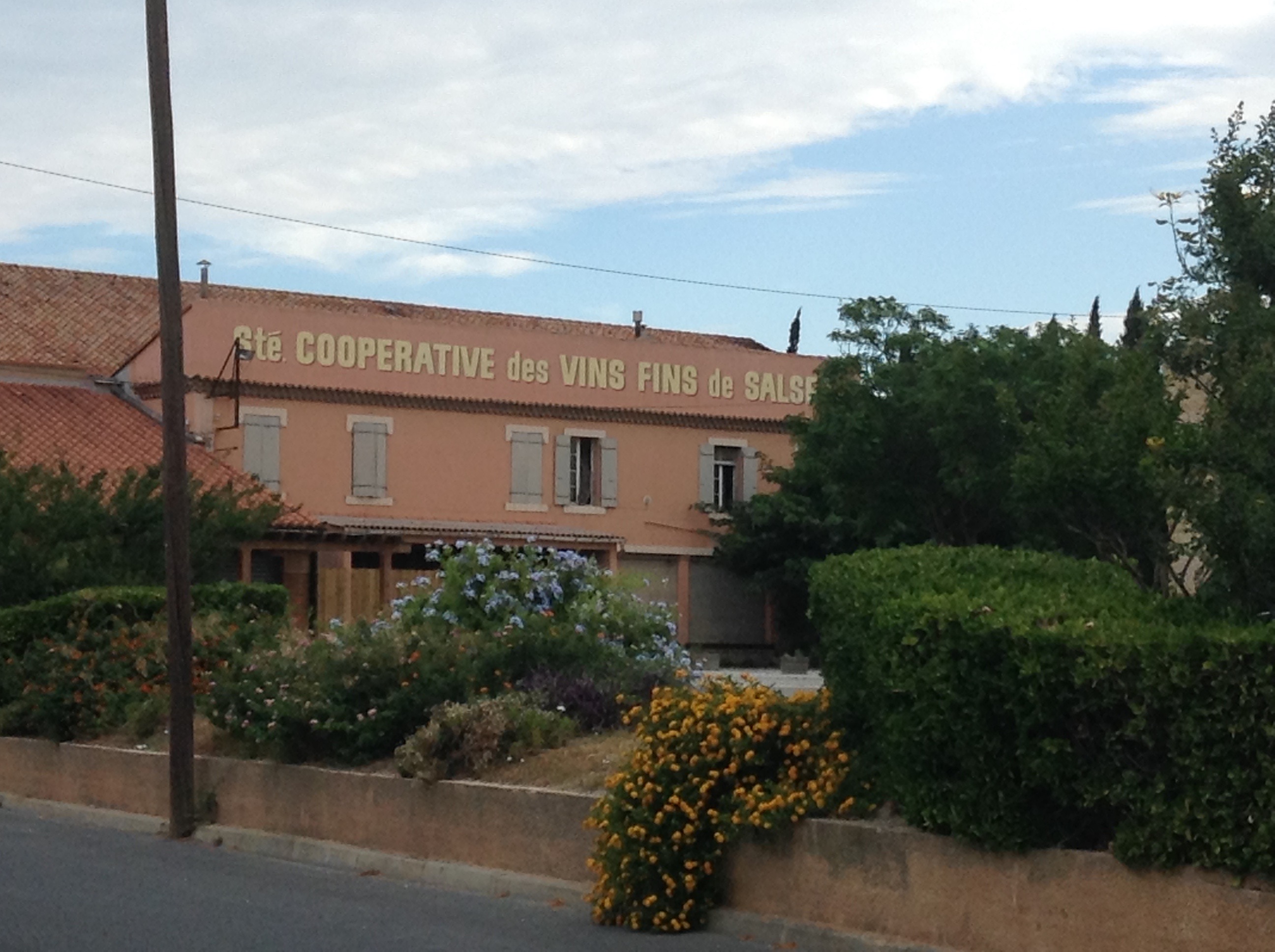
We walked up the street about 100 meters and saw the wine coop building, pretty little setting. Parking lot was empty because everyone was over at the market!

The wine coop in Salses-les-Chateau.
The wine coop in Salses-le-Chateau.

Less than 5 feet past the back corner of the wine coop building was an under pass for the train tracks. Honestly those train tracks looked much further away in Google maps. Good for us!

Pedestrian underpass for train tracks.

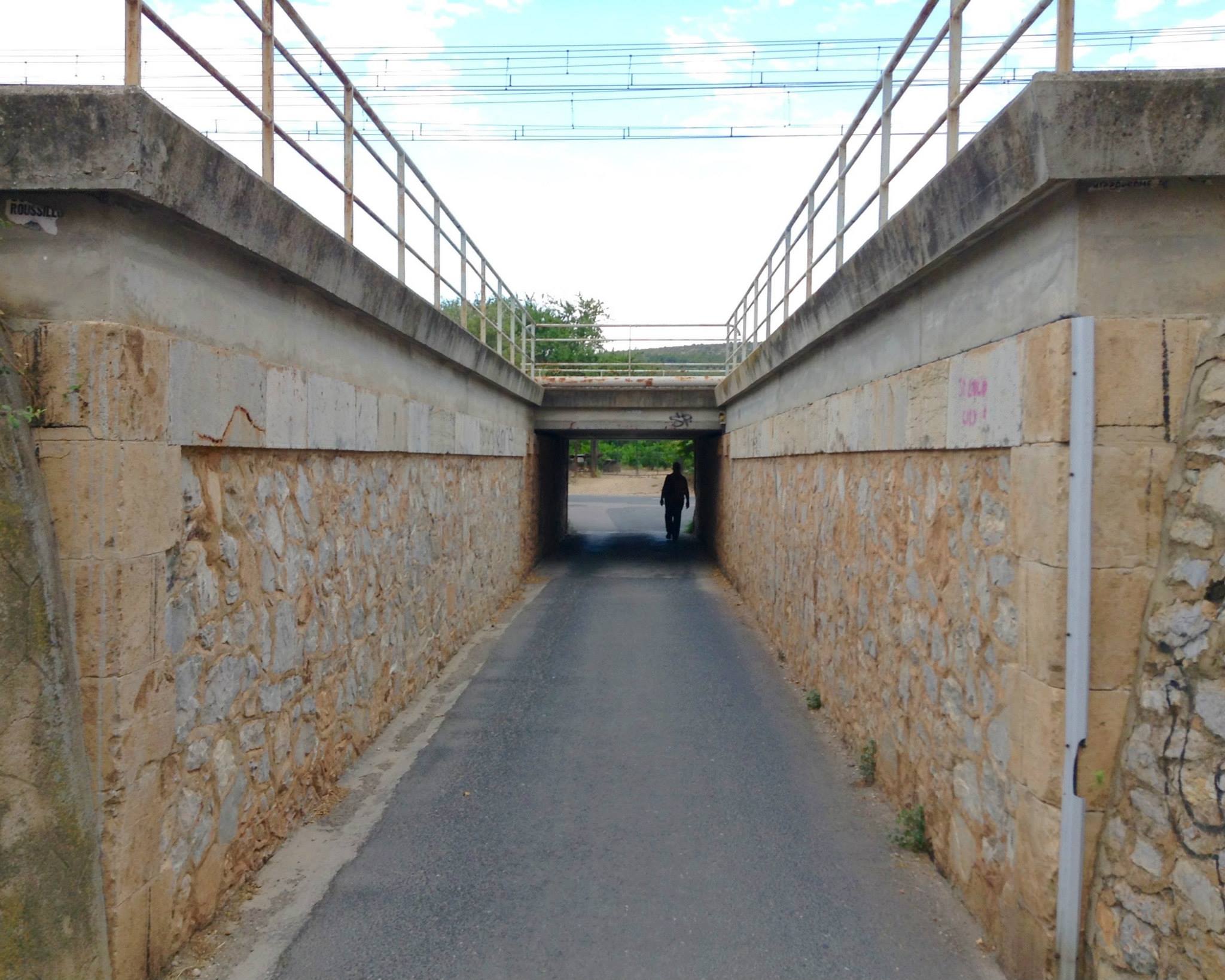
On the other side of the train tracks we took a right and realized that we were about 10 yards from the parking lot of the fort. Good thing I packed that lunch in case we spent half the day climbing a hill! That was an exhausting walk all 300 feet of it!

Some days there is just no way to make yourself look smart. Today was that day.

I know I studied at that map. I know that I’m cartographically challenged, but good Lord I just couldn’t help feeling like a complete idiot. Not only was the Forteresse de Salses not far at all from the center of town, the silly thing wasn’t even on a hill . . . it was sunk into the ground!

Model showing the sunken fort.

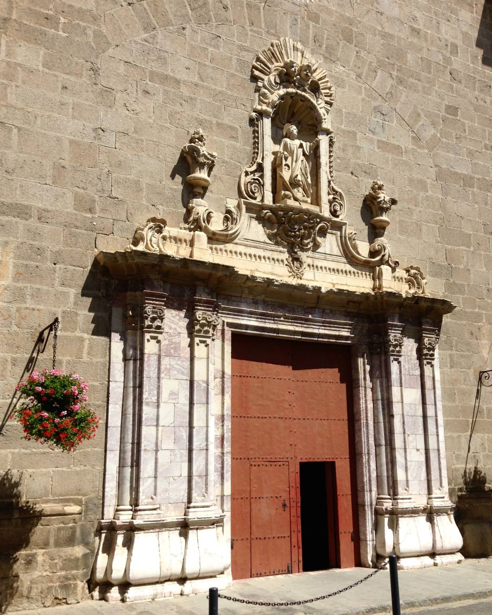
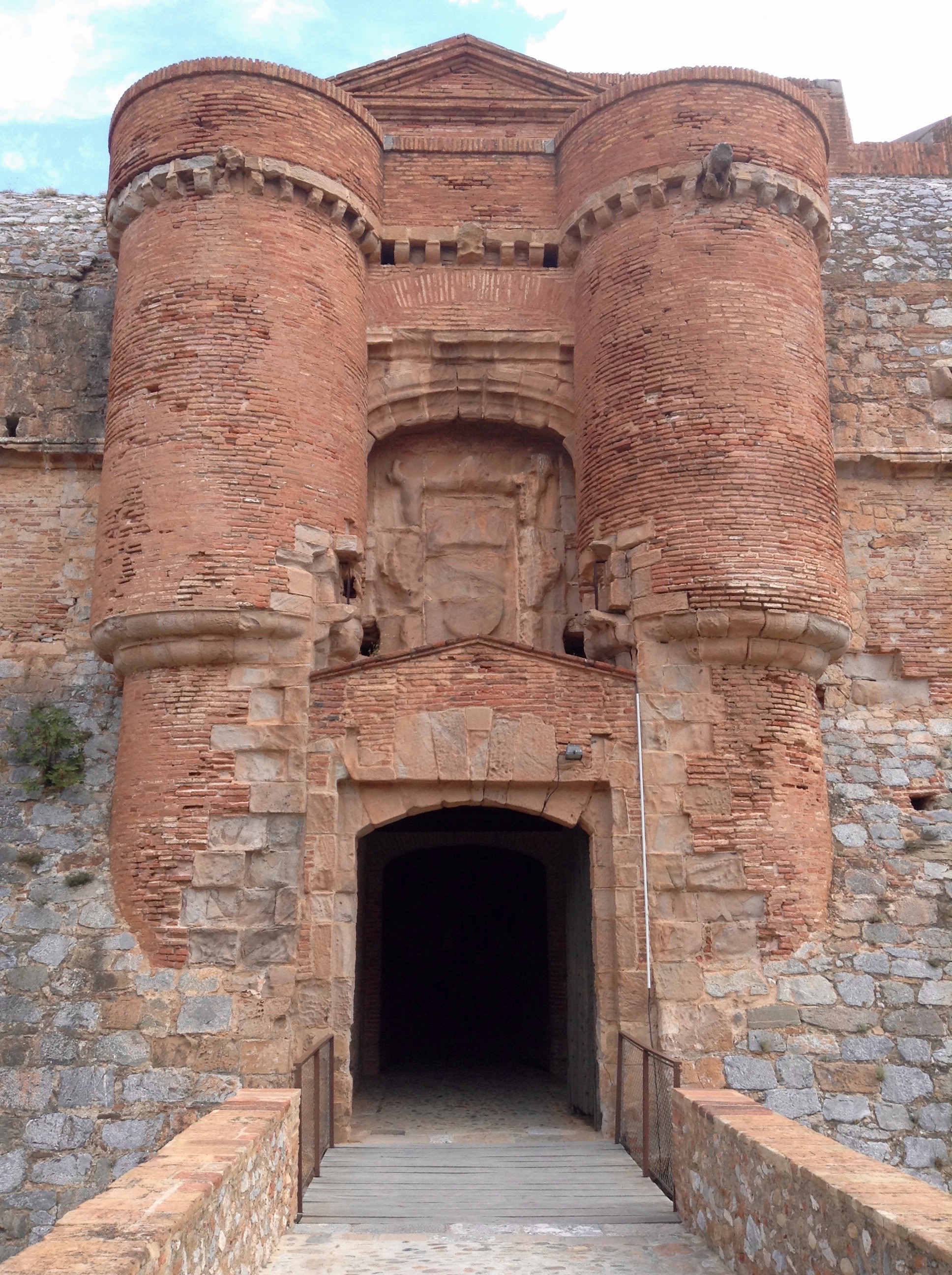
We arrived early to the Forteresse de Salses and had about 35 minutes before they opened for tourists. We took our time walking around this magnificent structure to photograph it from every angle. As forts go it is rather large and for many tourists it would seem enormous. But, having lived in the shadow of La Cite de Carcassonne it did seem a wee bit smaller!

1 South East Angle Tower 4 NE tower 2 east bastion
Alan in front of the moat with southeast tower(directly behind him), the northeast tower (middle), and the east bastion (right).

After they opened the doors we purchased our tickets and were rather surprised to be handed an informational pamphlet in English. This doesn’t happen often and we are so grateful when it does. Our French is still rather poor, we can puzzle out most things but having the information in English is just a special bonus.

South half-moon towers (10), the former drawbridge (11) has been replaced with a more tourist friendly bridge. Between the two towers is the crest of Aragon. Heavily damaged not much of it remains.
Main entrance after leaving the south bastion, the former drawbridge has been replaced with a more tourist friendly bridge. Between the two towers is the crest of the Kingdom of Aragon, though heavily damaged.

The south and north wings had an audio-visual art installation on lightning in the basement levels where the horses were stabled back in the heyday of the fort. There are ramps leading down to an hard packed earthen floor and the lighting was kept low for the art installation.

The central courtyard had another piece of art but for the life of me I couldn’t figure out what it was supposed to be. Looked like a half-circle bench, but too tall to sit on. No clue what it was supposed to represent. Nearby was the original well for the fort.

Tracy walking over to see the well in the center of the courtyard.

We took a look through the accessible areas of the south, east and north wings. They included stables in the basements of all three wings — two of which had the art installation; — barracks in the south and north wings — at one time there were three floors of barracks in each wing but time had reduced them to just one with a really high roof; —  there was a museum in the southeast tower filled with models, a wood boat, information panels, about 7 window displays showing artifacts recovered at the site; and a children’s classroom that was full of kids.

Alan standing behind the model of the Forteresse de Salses in the museum.

The northeast tower housed the chapel with a huge altar facade behind which was a staircase leading down to three small chapels and a well.

Alan standing in front of the alter and huge facade in the chapel.

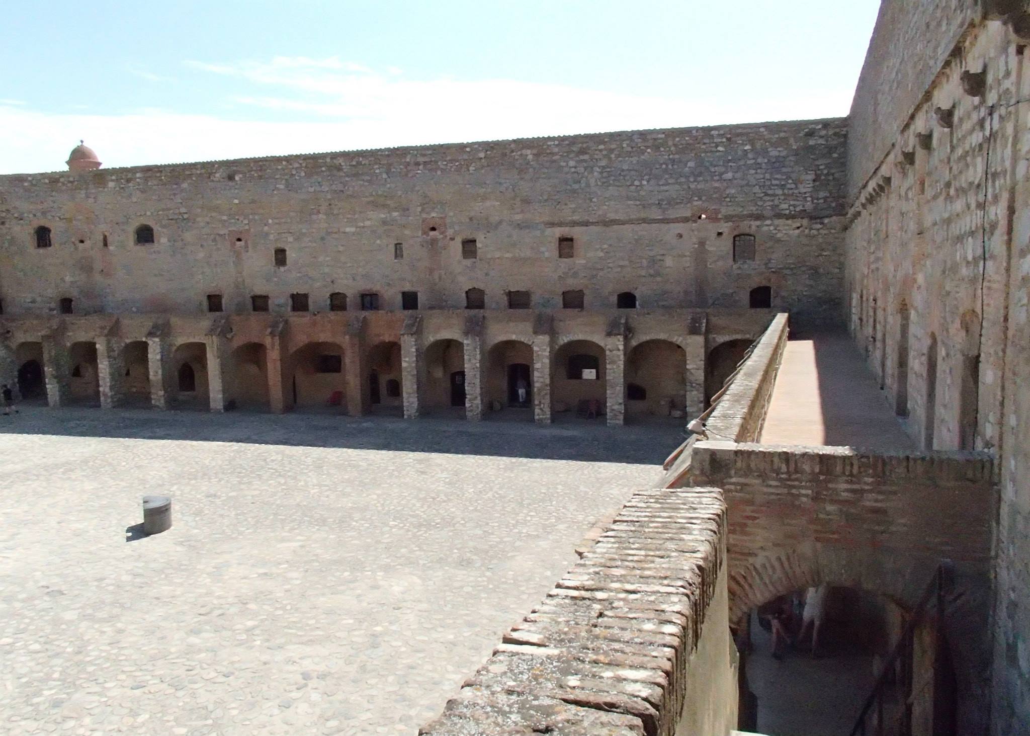
All three wings had arcaded porticos which offered plenty of shade and a few places to sit down. Above the south wing via a set of stairs was access to the ramparts for all three wings, but it isn’t accessible to tourists. From the landing at the top of the stairs there is a fantastic view of the courtyard, the inner moat and the interior rampart that was never completed.

The east side of the courtyard.
The west side of the courtyard.

When we finished touring the first three wings we grabbed a seat at one of the picnic tables outside of the south wing and ate lunch. A couple of wraps with ham, mimoulette cheese, and lettuce on corn tortillas, chips, and green grapes the size of small plums.

Saving the best for last, we headed to the inner keep area between the unfinished rampart and the entire west wing that also included part of the north wing, south wing and both the northwest and southwest towers. The southwest tower was specifically placed to provide access to the artesian well which provided water for the entire fort, including the kitchen, the boulangerie (bakery) and what looked to be a bathing room with two stone tubs. The area in front of the Chamber des Vannes was so cool and ventilated that it was like standing in front of an air conditioner!

The stone bathtub in the Chamber des Vannes.

In the center of the west wing was the keep, a seven story building that housed the dungeon, food stores, kitchen staff, and artillery with access to the roof for guard duty. To the left of the keep was the shop, to the right a huge boulangerie (bakery) with hundreds of hand-sized terra cotta balls used to bake bread on. There were six fireplaces, three of which were along the north side of the room above a huge stone table.

Bread was baked by heating the terra cotta balls and laying the bread dough on top.

Built into the ground level of the interior rampart was the kitchen — with running water and a stone sink and the largest fireplace I’ve ever seen, you could roast an entire cow inside and still have room. Next to that was the barn for horses and dairy cows.

Alan standing beside the huge fireplace in the kitchen.

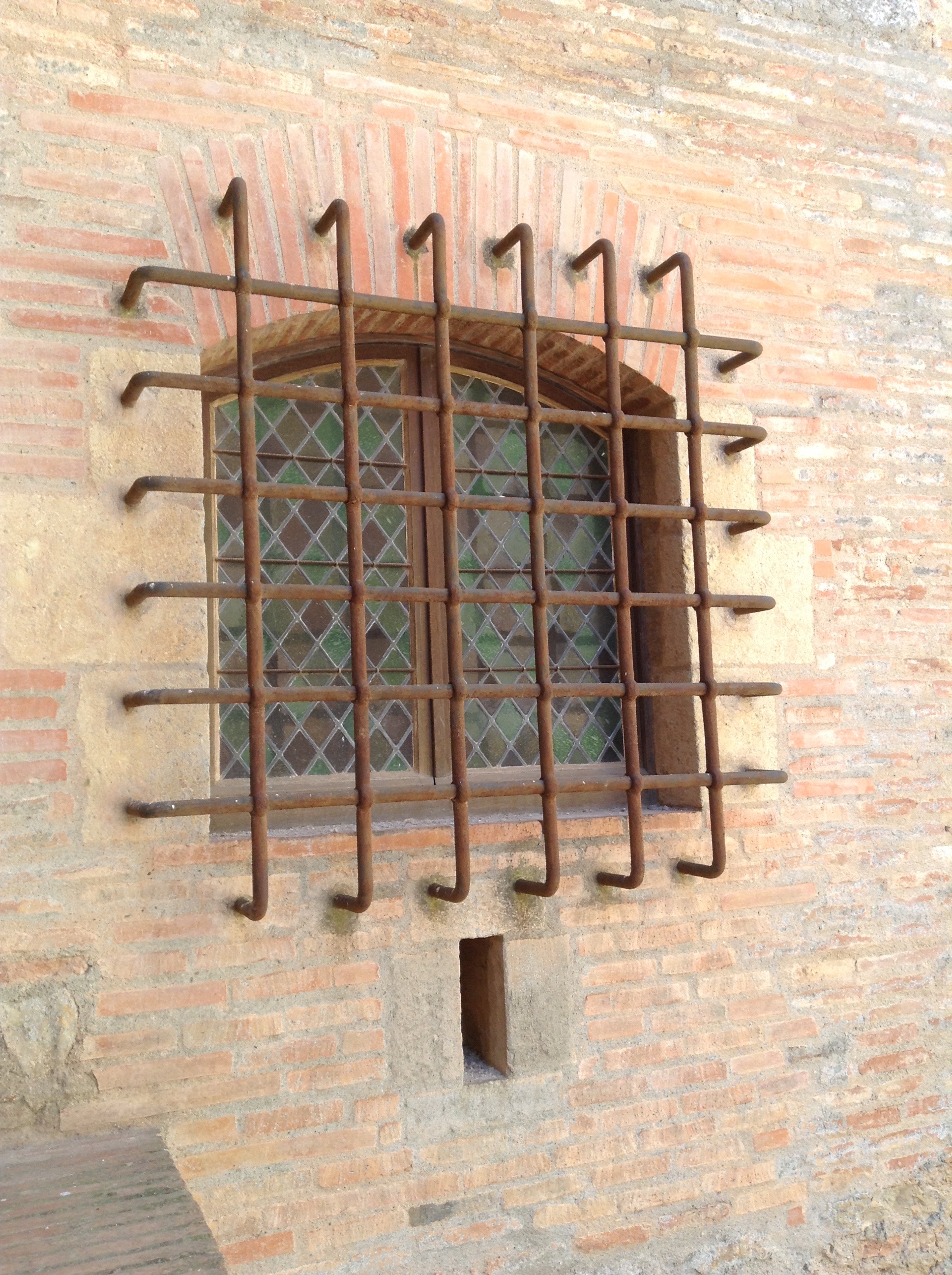
The western side of the south wing that was part of the inner keep had a small residence for the governor and his family. These were the only windows with glass. Diamond shaped stained glass windows covered the first two floors of the residence.

The barred, stained glass window of the governor's residence in the southwest corner of the inner keep.
The barred, stained glass window of the governor’s residence in the southwest corner of the inner keep.

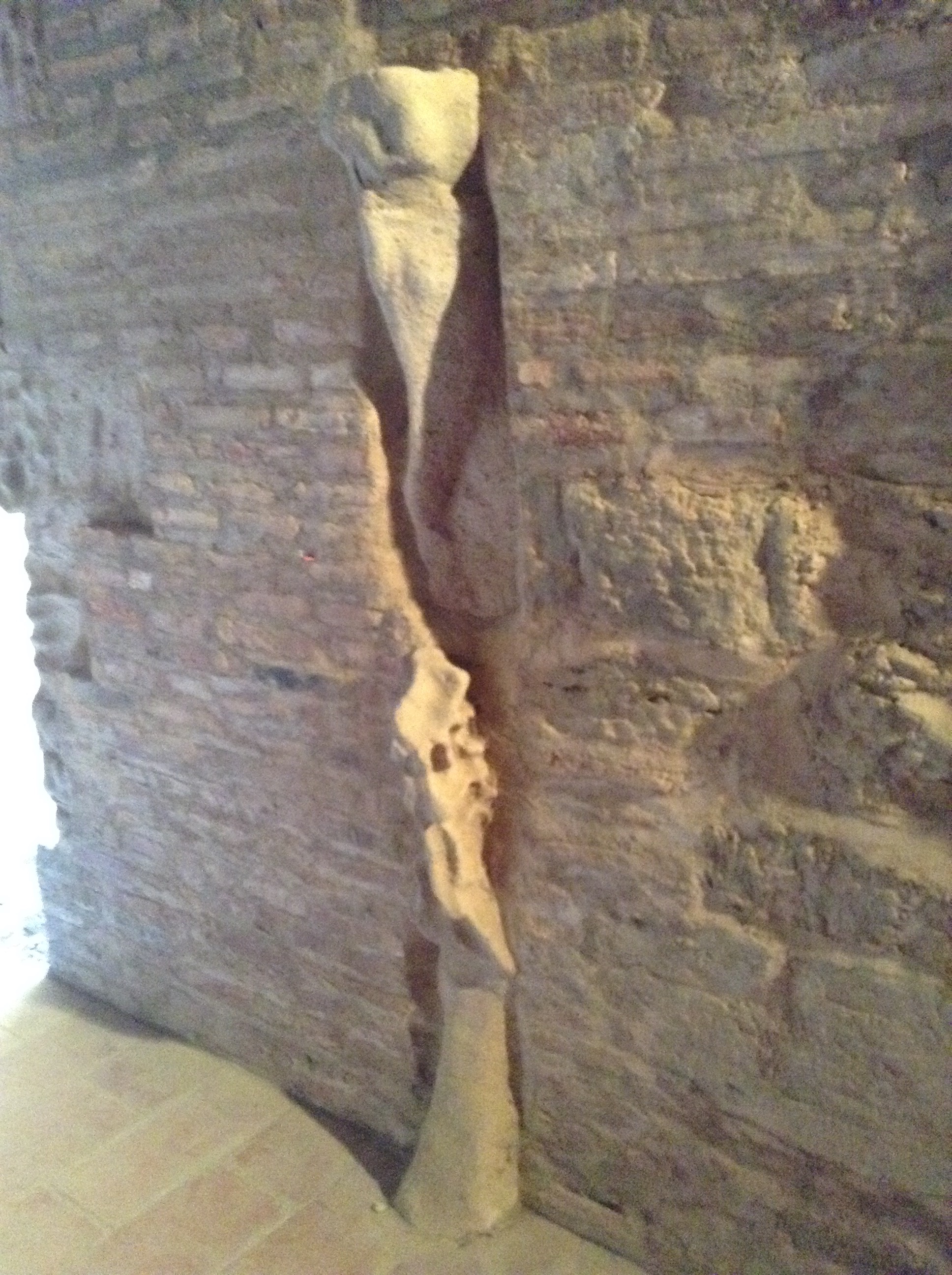
The western side of the north wing that was part of the inner keep was one large room with a small room at the west wall with a small door and a small pass-through window, originally I thought it might be a jail cell but we read in the history pamphlet that the dungeon was in the keep. So we are still clueless as to what was kept in there. The only thing of interest other than the weird tiny room was the remnants of a decorative piece in the center of the wall facing the inner keep.

The remnants of decorative detail in the northwest corridor of the inner keep.

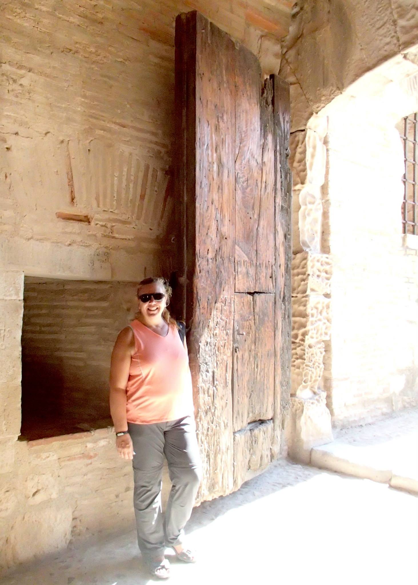
Entrance into the inner keep was made through another huge gate in the wall of the unfinished rampart. I read later that this was the last line of defense if the fort were ever taken. All of the food and cooking areas are included inside as well as that hidden well in the southwest tower. So if the fort was taken by enemies the soldiers and others could barricade themselves in the inner keep where they might be able to hold off invaders. There was also an underground tunnel from the northwest tower to the northwest bastion, so I assume there may have been an escape route planned from there as well.

11059774_10155881576155173_2808492130306007180_o
Tracy standing by gate to inner keep at the Forteresse de Salses.

Once we finished touring around, we headed back to the gift shop where I picked up a bottle of lavender syrup. The restrooms were in the basement and were added into an existing area so it did seem a bit weird to see huge rocks behind you while washing your hands!

The restroom in the gift shop.

The Forteresse de Salses is definitely worth the time to visit. For a more detailed account of the building see our post Forteresse de Salses, history and extras.

Micro-Adventure: Ille-sur-Têt

A new phrase that has gained popularity with the husband: Micro-adventure. It’s the perfect word for our little day trips to see the cities and sights here in the Pyrenees-Orientales region of France.

Monday’s micro-adventure was to Ille-sur-Têt (pronounced Eee-ya Sir Tet), specifically to Les Orgues d’Ille-sur-Têt and hoping to squeeze in a visit to the Hospice d’Illa and St. Etienne’s as well.

As we have been traveling to nearby cities via the 1 Euro bus system, we try to make our first stop the Office de Tourisme or rather coffee then the tourist office. Picking up a town map and browsing through the collection of brochures for other places of interest. Alan usually handles getting a copy of the map, I do the browsing. After returning home we look through all the new offerings and select a Top 5 list. Les Orgues d’Ille-sur-Têt was #1 on our Top 5. It is a natural geological sight, very reminiscent of Bryce Canyon, just much smaller.

So Monday morning arrives way too early, our day was meant to start early but a dying battery in the smoke alarm decided to go off at 4 am. Then Sami decided that she was done sleeping and we all needed to be up and someone should take her for a walk. I let Alan take her while I stayed home with a cup of coffee,. Shameful I know, but I drink coffee everyday and he doesn’t. So the alarm for 5:30 got shut off and we started the day a bit earlier than planned. Why is it that batteries in smoke alarms only run out in the middle of the night? Have you ever had one signal a replacement during the day? Neither of us has, it seems that only in the wee hours of the morning do smoke alarms need new batteries . . . hmmm, like their little, plastic lives have no meaning unless something has been tested . . . like your heart rate recovery time.

Well, we weren’t late for the bus. After arriving in Perpignan we talked to the gentleman at the bus kiosk, asking him for the route maps for the lines that went to Ille-sur-Têt. He handed us brochures for all the buses that service that area. We walked over to our favorite coffee shop across from the train station and while waiting for our coffee and chocolate croissant, we found that the 200 bus would be the first to head towards our destination. It gave us about 40 minutes to enjoy our breakfast. Perfect! If you transfer within two hours of your first ticket purchase you do not have to pay a second time.

Ille-sur-Têt was reachable via the 200 bus but is also serviced by the 220, 240 and 260 lines. We had the brochure for Les Orgues in hand and showed it to the driver. 25 minutes later, when we reached the correct stop, he gave us the thumbs-up and we were on our way. Ever so helpful, he even explained how to get to Les Orgues, but our French isn’t quite good enough to understand all the directions. We found the Office de Tourisme instead and asked for directions. The lady there was very helpful and in a matter of minutes we were on the right track.

On our return from Les Orgues, we found a little side street that led to St. Etienne’s, the Mairie (town hall) and a few interesting corner gardens, one named for Jean of Arc and another for St. James. When we found our way back to the main street we stopped at the Bar Le Nationale Brasserie for lunch. We ordered beer. When we finished those we ordered burgers. A “carafe d’eau” (bottle of tap water), which is normally refrigerated and refreshingly cool without having to pay bottled water prices, still wasn’t quite enough to quench our thirst. It was 36 degrees Celsius, approx. 98 degrees Farenheit. A very warm day.

After lunch, we wandered about town until we found the Hospice d’Illa. Wandering through and seeing some of the very nice pieces in their permanent collection as well as some very nice Baroque works of art. They also had a display in the lower chapel galleries of some of the interesting stained glass windows from around the area.

When we finished all our “must see” items, we wandered through town a bit more and spotted some beautiful old buildings, interesting alleys and walkways. We both really enjoy wandering through a former walled city that has been around for centuries. Though the town updates and changes, you often find little pockets here and there of original cobblestone, or gallery overhangs, or covered entrances that still bear the original wood beams or remnants of the original paint, sometimes an old sign or an entire side of a building that has old advertising.

It’s the little things that make our micro-adventures so enjoyable. We both love architecture, sacred or otherwise. We both have a sense of wonder at the way people in Europe live with their history. If you just take the time to wander without a destination in mind, you find the most amazing, little surprises!

After we wandered back to the main street and checked the schedule on the bus stop, we had about 40 minutes to kill before the next bus. We headed over to a different cafe and had another cold drink. While we were sitting there, we saw four different tractors go by. Life in a small town! Ille-sur-Têt is a small town of around 5,000 people but they sure do have a lot of lovely history.

Micro-Adventure: Les Orgues d’Ille-sur-Têt

We have found that most of the staff in the tourist offices speak at least a little bit of English. Usually enough to get a map or directions. Ille-sur-Têt’s tourist office didn’t have printed city maps, but rather a large laminated map. When we asked for a map and directions to Les Orgues, the staff person pointed out the route and we jotted down the names of the streets. She said, “Just follow the signs, it is not far.”

Directional sign for Les Orgues

And it really wasn’t. 2 kilometers from the bus stop, about 20 minutes of walking and we were at the Visitor’s Center for Les Orgues d’Ille-sur-Têt. Most of the walk was on wide sidewalks. There were a few places with little room for pedestrians but drivers in our region are used to pedestrians, cyclists, runners so they just slow down and move over . . . well sometimes they slow down!

Alan on the walk out to Les Orgues

We went into the Les Orgues Visitor’s Center and while Alan purchased the entrance tickets (5 Euro/each) I browsed through the brochures they had laid out. Oddly they had more than the tourist office in town and I picked up several I hadn’t seen before.

Access to the site was gained by a short walk (800 meters) on a dirt path with an interpretive trail. The Visitor’s Center had guide books that included information about the flora and fauna, waterways and flooding, etc. We dutifully stopped at each of the numbered markers and read the information in the mini guide book, which was in English.

One of the interpretive trail markers.

We were in the Têt Valley, an area called “Ribêral” meaning “river area” or “born from rivers.” In the distance is the Canigou Massif (2,784 meters) topped by the “dog’s tooth peak.” It is the last high summit of the Eastern Pyrenees, an important symbol for the Catalan people.

Earlier the area had another name, “El Val del Infern” (Hell’s Valley). The landscape was very dry. Along the interpretive path we read about the Mediterranean farming for this small area which mainly consist of vineyards, olive, almond and fig trees. A startling contrast from the rest of the Têt Valley which is well irrigated and known for its peach production. The peaches have vivid red coloring due to the reflection of the sun on the sand.

Part of the interpretive trail, an olive grove shows the types of trees that could grow here before the area was irrigated.

Right after marker 2 was a sculpture garden. The sculptures were made from a lot of different things, found items in most cases. The small statue of four girls dancing were made from old axe heads. My favorite was the T-Rex skeleton. Much larger than the rest and almost hidden around a bend in the path, it drew smiles from everyone passing by.

Alan and Rex
Alan and Rex

Upon reaching the entrance to Les Orgues, we handed our tickets to the young lady at the kiosk and entered the world of fairy chimneys. The site opens up like an amphitheater with walls of gigantic columns 10 to 12 meters high (30 to 40 feet).

Alan with the "fairy chimneys" in the background.
Alan with the “fairy chimneys” in the background.

It takes about an hour or so to walk through the small park, including time to take photos. The area is beautiful with white and tan columns topped by layers of rock and in some cases trees and shrubs. The columns look like chess pieces or organ pipes or chimneys. The formations are called by many different things, chimney rocks, fairy chimneys, organ pipes, hoodoos. Since individual formations had no official names we were making them up, such as the “amphitheater” or “chess pieces.”

The "chess pieces."
The “chess pieces.”

The guide book stated that the area is in a constant state of change. The sandy rock columns change with each drop of rain as they have for the last five million years. Areas like Les Orgues are scattered around the Têt Valley but nowhere else are the results quite as spectacular. However the name Les Orgues means The Organs a name which is typically used to designate basalt streams that have solidified into long pipes or columns. This particular area is not volcanic in origin, just named before the term was designated for basalt columns.

Close up of labyrinth wall detailing water run-off.

There was also a “Labyrinth” trail (about 100 meters long) that wound up through the ‘chimneys’ to a dead end. The guide book did state that it was one labyrinth that no one would get lost in!

Tracy on the labyrinth trail.
Alan walking up through the labyrinth.

We also learned that the area was home to aurochs, cave lions, cave bears and cave hyenas in prehistoric times. No mention of dinosaurs . . . except the metal T-Rex.

I had brought my good Nikon with me, but my batteries died . . . both of them. I think after 4 years they aren’t up to the job anymore or perhaps it was just a bad day for batteries! But we had both brought our iPods, training ourselves to use them for our big hike on the Camino de Santiago coming up in just about five weeks.

Back at the Visitor’s Center we enjoyed the air conditioning inside while purchasing a couple of cold drinks then sat outside on the covered terrace. Once finished, we headed back into town for lunch and visits to the churches in town. St. Etienne was visible from the bridge across the Têt River and Hospice d’Illa is a few blocks away — more about them here.

In the photos you’ll notice strips of color in the columns. The white corresponds to clay, the ochre color to iron oxidation, the brown or grey spots are lichen and moss which will turn green again with enough water.

If you are ever near the area, it is definitely worth a stop. It doesn’t take long to walk out to the site and have a look around, but is definitely a “Do Not Miss” place in this region.

This slideshow requires JavaScript.


Micro-Adventure: Hospice d’Illa and St. Etienne in Ille-sur-Têt

After visiting Les Orgues in the morning, Monday, July 20, we headed back to town to see the beautiful church, St. Etienne, that we had noticed while hiking the 4 km out to Les Orgues and back into Ille-sur-Têt.

.

The current building circa 18th century expanded and remodeled an earlier 12th century church.

St. Etienne (St. Stephen in English; St. Eteven led Pedrequet in Catalan)

The first written mention of this pre-Romanesque church dates to the 10th century in 982 as a donation to the Abbey Cuixà. In 1016, a document refers to “the old church” while referencing the, then current, construction (one of many expansions throughout the centuries). To understand the size and shape of the earlier 12th century church you have to imagine it oriented east to west in the nave of the current building (from right to left). The building itself was at one time part of the wall surrounding the city (parts of which are still visible) and near the castle (which no longer exists).

The current interior of St. Etienne. The original church would have been
The current interior of St. Etienne. The original church would have been where the area where the pews now sit. The large organ is visible to the right above the arched side entrance (most likely the original entrance to the earlier church).
Remnants of the original ramparts

The bell tower was added sometime during the 1400s. The current tower was inaugurated in 1875, it’s most recent reconstruction. Originally, it had a defensive role as much as a religious one. It was used as a dungeon, a records room, a reliquary and treasure room. The bells in the upper part of the tower are truly remarkable. There is a carillon of 16 bells each an octave and a half apart. The largest and oldest is the F sharp major, cast in 1757. Another dates to 1766. The operators climbed 116 steps to use levers and pedals to operate the bells. In September 1933 an electric carillon keyboard was added and the bell ringers became a distant memory.

The bell tower housing all 16 bells of St. Etienne.

Excavation for a well some 50+ years ago revealed headstones nearly 30 meters underground from the graveyard that once laid beside the church. A more recent excavation near the current entrance revealed bones from one of the original graves.

The upper section of the main facade of St. Etienne in Ille-sur-Têt.
The main doors of the entrance facade.
The large entry doors of the main facade.


Just a few blocks away was the Hospice d’Illa, a complex of several buildings that date to the 12th century.

The gated entrance to the chapel and hospice with St. James watching from above.
The original gated entrance to the chapel and hospice with St. James watching from above. The building on the left houses the small chapels, the building on the right a team of is currently being used by a team of restoration experts.

Hospice d’Ille-sur-Têt (Hospice d’Illa in Catalan)

Part of the Camino de Santiago, hospices like this offered refuge to those making the pilgrimage across Spain to the final resting place of St. James in Santiago de Compostela. There has been a large network of hospices operated by the Catholic Church, and her followers such as the Knights Templar and Knights of Malta, and other volunteers, throughout Europe for centuries. The Hospice d’Illa, though not the oldest of those still in existence, dates to the 12th century.

The complex of buildings at Hospice d’Illa include: the Hospice Saint-Jacques (St. James), which dates to the 12th century (the current building was remodeled in the 14th century); the Romanesque church Nostra Senyora de Rodona, 12th century; funeral galleries; and medieval ramparts which date to the 16th century. The church and funeral galleries of the cemetery were the privileged place of burial for the Illois (what the people of Ille-sur-Têt call themselves).

Side entrance of the original hospice.
Arches near the ramparts on the hospice grounds.
Arches near the ramparts on the hospice grounds may have been part of the funeral gallery; though the cemetery no longer exists.

The Hospice continued to serve as a community hospital until 1981. Unfortunately it was not open for our tour. Current restorations are in the works making the area off-limits. The building to the right of the gated entrance has been tuned into a workspace for a team of experts handling the art restoration for the hospice and church. A display in the reception area of antique restoration tools showed that restoration efforts have been ongoing for quite a long time.

Display of antique restoration tools in the reception area.

The ramparts, which are integrated with the church’s North and East walls, were part of the city’s fortification system (a section of which is visible near the current parking lot along the east side of the church). The closest access for the hospice and church were through the fortified gate of Parayre (which still exists and is still used as a main street for that section of town).

Ramparts of the original city defense system which incorporated the East wall of the Hospice.
The current sign for the Hospice outside the gate near the rampart tower.
Signage for the Hospice near the rampart tower, it hangs above and slightly to the left of the Parayre Gate..
The xxx Gate which allowed entrance into the city near the Hospice from inside the ramparts.
The Parayre Gate which allowed entrance into the city near the Hospice, taken from inside the ramparts.

The church consists of a single nave, typical of early churches of that era, with an incredibly high ceiling and a small sacristy off to the right. We did not see any of the grave markers inside the church, but most of it was covered with carpet for the museum display. There were eight small chapels on the ground floor opposite the main entrance to the nave and connected through a small hallway with St. James painted above the doorway (found during restoration efforts). Eight additional chapels on the floor above are accessed by a small tight staircase. The small chapels were dedicated to the many worker guilds of the city. Above each of the chapels are Roman numerals which were also found during current restoration work.

St. James painted above the small hallway between the main nave of the church and the ground floor chapels.
Staircase with handcrafted metal railing.
Staircase with handcrafted metal railing.

These days the church is a museum, the sacristy (to the right of the altar) holds remnants of Romanesque frescoes discovered during restoration. The nave has holds a variety of pieces found over the years, sections of stone columns, a model of the original church, and some large information pieces – in French, of course! The chapels on the upper floor have a permanent collection of artifacts from both the Hospice d’Illa and St. Etienne’s. The chapels on the ground floor have a rotating exhibit. Currently it is an exhibit of Romanesque and Baroque art from around the region.

The interior of Nostra Senyora de Rodona housing a small museum.
Romanesque fresco found during restoration.
One of several Romanesque frescoes found during restoration.

The altar is still in place and was specifically crafted for the church by guilds operating within the city. It is a beautiful white marble carved with birds. I didn’t recognize which type of bird, they look a little bit like Cormorants to me but are most likely something indigenous to the area. The large altarpiece has three alcoves that are now devoid of the wood statues they once held — though some are now on display in the permanent gallery. (*We did notice that at some point in recent history that someone had added carnival lights around each of the alcoves, many of the small bulbs were still in their sockets.)

The altarpiece of
The altarpiece of Nostra Senyora de Rodona.
Altar detail of doves.
Altar detail.

It still amazes both of us that before we moved to France we had never heard of the Camino de Santiago, well just a short sound-bite on an episode of Rick Steve’s Europe. Literally a 5 second blip. Yet now that we have traveled a bit of the Camino ourselves, we find we are surrounded by the richness of this 1000 year old tradition. Kind of like when you buy a new car and then notice them everywhere you go.

We find references everywhere. The hospice in Ille-sur-Têt is one, the pilgrim hospital and small chapel in Carcassonne that was just at the end of our street another. We find that way markers that pop up all over, signs along the highway that denote it follows the Camino de Santiago in a particular section, and recently a brochure which explained the route from Montpellier to Perpignan and included the albergues available between the two locations. The other day we saw a museum display of old horseshoes and spurs from a fort we were visiting (Fortress le Salses). The spurs had a scallop shell design, the symbol of St. James and the Camino de Santiago. So if you’re ever visiting Europe and run into a scallop shell design, you’ve found a piece of the Camino. Send us a photo!

As we prepare for our next Camino, we are in awe that it has become such a huge part of our life here in France. We are elated when we notice that there are trails near or in the places we live, and are constantly amazed that this millennia old pilgrimage still has a huge following. We’ve even been discussing doing the shorter Portuguese route next year and taking Sami along with us. Though we would have to stay in hotels because the albergues do not allow dogs. She’s SO spoiled!

This slideshow requires JavaScript.

Micro-Adventure: Banyuls-sur-Mer

The first glimpse of the Banyuls-sur-Mer (literally translated to Pond by the Sea – the pond was drained in the mid 1800s) area was of the Site of the Paulillies. It’s an abandoned dynamite factory that was reclaimed as a regional historic park. The factory still exists but the other 70 outbuildings have since been taken down. The vineyards flow right out to the edge of the coastline. The Banyuls red dessert wine produced here is supposed to be the best in France. We’ll have to find that out next time. We meant to pick up a bottle but got distracted later in the day.

After stepping off the bus at Avenue de Gaulle the air is immediately filled with the sweet scent of flowers, unusual for a sea side city. After setting Sami free from the bus bag that she dislikes — we both carry small day packs for traveling and mine is perfect for holding Sami’s bus bag while we hike around — we look around and find a sign pointing the direction of the tourist office. It is just up the street and sitting on the beach.

While Alan talks with the receptionist, I look through a rack of flyers. I was expecting them to be the same as those I saw in Port Vendres, and was surprised when they were different. I picked up several that looked interesting. Three for military forts; Fortress de Salses which is a national monument, Fort Lagarde designed by Vauban and Les Remparts de Vauban which is a UNESCO World Heritage site. One chateau in Castelnou, the Center for Roman Sculpture, a chapter house with a 9th century abbey that has been updated with 3 architectural styles since it was built, the Hospici d’Illa with art in both Roman and Baroque styles, and the one I am most anxious to visit Les Orgues. Les Orgues is a natural park in the Tet valley with what are called fairy-chimneys. It looks to have all the natural beauty of Zion in Utah or Garden of the Gods just outside Colorado Springs.

Alan returned with the city map and I waved my flyers telling him I have new places to visit on future trips. We offer the receptionist a “Au Revoir, Merci Beaucoup, Bonjourne” (Goodbye, Thank you very much, Have a great day) and head out to find coffee.

The day is breezy and cool, perhaps a bit more breezy than is comfortable but at least it wasn’t hot at 9:30 am. We walked past a few open restaurants and stop at one where another couple is enjoying a coffee. At Le Corsaire we found a table near the windbreak and grabbed a seat. Almost immediately the server is there asking what we would like to drink. Alan says “due cafe kreme” (two coffees with milk) and when they arrived a few minutes later I was pleased to find that the coffee was very, very good. Probably the best we’ve had since leaving Carcassonne and my favorite La Petit Moka in Place Carnot.

While enjoying our coffee, we took a look at the map. Banyuls-sur-Mer is a tiny town, a population of only 4,650. Across the street is a wide beach along the north side of the bay. The multi-arched main road into town is quite picturesque and though we would have loved to wander out to the point on the north end of the bay, the beach is not dog-friendly and it is the only access to the beautiful arched structure. We decided instead to visit the l’île Grosse first. The l’île Petit is also only accessible by the beach so wasn’t on our “to visit” list for the day.

After finishing our coffee, we cross the street to walk along the boardwalk next to the beach. There is a small park area just past the restaurants where there is a small statue of naked men dancing. It’s fairly abstract though I was quite certain all the figures were male. The shade from the trees offered a challenge to photography but we both stood there for a few minutes trying our best with our iPod cameras.

Normally we travel with a full range of cameras. Alan’s Olympus big camera and waterproof camera, My Nikon big camera with a 36x zoom and my AWS 100 waterproof camera. But lately we’ve just been using the iPod 5 camera trying to get used to a smaller camera for our upcoming Camino trip. There were several times throughout the day that I wished I had brought my bigger Nikon. Banyuls is a very picturesque city, from nearly every angle.

Just before the bridge is a small police municipale. We know this is a small town and that most of the northern side of town is pedestrian only. But we both had a laugh at the police vehicles in Banyuls-sur-Mer, no mini-vans, no cars, nope nothing but three small scooters parked out front. Just like the ones used for pizza delivery in Carcassonne! But it does offer a glimpse into the safety of the area that they have no need of anything more than a scooter to keep the peace!

As we walk along the coastline, crossing the bridge for the river which is dry and being used as additional parking, we made our way to the south end of town. Just beyond the bridge is the harbor and small boats are parked in neat rows. Nearly all the watercraft are white-hulled with sails wrapped in bright blue. Except one small bright orange boat with an outboard motor nearly as big as the boat. Alan made a comment about way to much motor while I countered with “one of these things is not like the others.”

The walkways have all been redone with neat red brick and the sidewalk is wide enough to allow the three of us to walk side-by-side while still allowing bicycles to pass two abreast. The street sits up higher and overlooks the harbor and we realize about halfway down the street that there are small shops underneath us.

Where the sidewalk ends is a pretty rock garden with the name of the city and a few iconic statues, an anchor, a bunch of grapes and a sailboat. Above is the curved path that leads to the Universite de Pierre et Marie Curie and the Arago Laboratory and Aquarium. The aquarium was open but there wasn’t anyone at the desk so we continued out to the l’île Grosse. Sami got very, very excited at this point. She LOVES the ocean.

Just before the gate at the start of the path out to l’île Grosse there was a small opening to the breakwater with a couple of stairs. Sami ran up the stairs and was wiggling with excitement. The wind was making for some active wave action and the water was crashing against the large gold and red rocks. Sami just couldn’t help herself and ran out onto the breakwater ready to chase the waves away.

We called her back over and continued walking toward the point along the walled breakwater. The entire area is a protected marine reserve and the wind is kicking up beautiful waves. The water near the point is the same bright blue that you see in glacial ice; so clear you can see the rocks under the water. Sami was in heaven. We were alone both at the base of the breakwater as well as at the top of l’île Grosse where there is a wonderful 360 degree view of the Mediterranean and the city. Another sculpture by artist Aristide Maillol sits at the top of l’île Grosse. Maillol is a native son of Banyuls-sur-Mer he was born there and died there. His works of art are scattered throughout town.

Just to the south of l’île Grosse is the cliff area where the Pyrenees Mountains meet the sea, the area is beautiful and wild, waves were crashing so high that a lone house visible from where we stood was getting misted by salt water. We rather liked having a glimpse of the Eastern Pyrenees as soon we will be heading west to cross the Pyrenees from France to Spain on day one of our hike to Santiago.

We stayed for a while enjoying the view, watching Sami chase scents of the sea and laughing at her exuberant behavior, enjoying the breeze as the day warmed up. On our return we noticed a small fort overlooking the start of the breakwater. The stairs are hidden to the back of the University de P. et M. Curie so we missed them when we walked past them on the way out to the l’île Grosse. Once we spotted them Sami dashed up the first set to the landing then looked back to see if we were going to follow. We decided to give in to her request. Following her up the remaining two flights we arrived at a small lean-to style shed. It was obviously being used as a home by someone as there was a mattress and bedding on the floor to the right and a few shirts and a pair of jeans flapping in the breeze from a peg on the left. We opted to continue climbing and not disturb this makeshift home. At the very top was another great view of the Med and the city. Another statue, this one of a fisherman, sat in a small rock garden, though inaccessible due to a locked gate.

On our return trip to the ground level, we spotted a small set of four steps leading to a barred window. I was pulling out my iPod to snap a photo when Sami dashed up the steps to see if anyone was inside. Alan was standing to one side and I managed to get a photo of Sami looking into the window and seeing her Daddy’s reflection. The next four photos were of Sami looking from Daddy to his reflection in the window. Sometimes she is just too funny to watch. Reflections really confuse her. Her least two favorite things are “reflection” dog and “shadow” dog, she hates them and they follow her everywhere.

We walked back toward the row of restaurants along the upper path, stopped to snap a few shots through the metal frame thoughtfully provided by the city to denote a photo op. When we reached the staircase leading to the harbor-front shops we decided to walk back toward the University/Aquarium building and see what shops were open and what they were selling. Most were art galleries of varying quality. One had a painting we both really liked, but without a permanent home here we don’t really bother with artwork for the home. A couple of dive shops were tucked in between the galleries and we even watched a group getting ready for a dive. Reaching the end, we walked back again on the upper level in search of lunch.

After checking all of the posted menus and specials for the 5 or 6 restaurants with ocean views, we decided on Les Corsaires again. We were so not disappointed by our choice. The food was amazing. Even more so was the server who had to dash across two lanes of traffic to place the order and again to bring out plates to waiting customers. There is a cross-walk between the two dining areas (one on either side of the busy street) but we noticed the cars didn’t slow down for our busy server as she gracefully glided across the street and back. It was a little like watching a real-life game of Frogger. I know there were at least three times that I grabbed the edge of the table as if I were about to witness an accident.

Our lunch arrived and while Alan’s burger looked amazing, especially with the hand-cut fries, my salad was a work of art. Served in a tall while bowl four slices of a hard cheese with a peppered edge, similar to parmesan but not as salty. lined the bowl. The mixed greens were baby shoots of five or six different greens. The ones that always remind me of weeds, but taste very good. At least one of the them tasted peppery. On top of the greens around the edge of the bowl were thin slices of Spanish serrano ham and in the middle were paper thin slices of cantaloupe. There was no dressing, but honestly the salad was so good it really didn’t need anything.

Sami had dry kibble, which she grudgingly ate while sitting under the table. But then the clumsiness gods smiled upon her when Daddy knocked over the bread basket. Happiness ensued. Sami finished her meal in high spirits.

There is something so uniquely European about al fresco dining and whenever possible I like to sit outside, even if it’s raining. Les Corsaires had a great view of the Med and a lovely rooftop providing plenty of shade while still allowing the breeze to come through. It was one of those rare moments when the food is great, the company terrific, the weather gorgeous and the dog is behaving that just seems like a small glimpse of perfection. I live for those moments.

Upon finishing lunch we decided to do the”Circuit Cap d’Osna,” or artists’ walk through the fishermen’s quarters, outlined on the map.* Heading to the north end of town where most of the streets are nothing more than staircases and no cars can possibly travel, we easily found the first of 15 markers that would lead us around the historic part of the small city. Winding through the steep and staired alleys we saw the most beautiful houses in what used to be the fishermen’s quarter or perhaps smugglers’ den would be more accurate.

* Note: the city map is wrong. The route has changed. The city map will get you to the first marker, the directions on the first marker will get you to the second, and so on. 

In addition to one famous artist, the area was most notorious for the amount of smuggling that took place, with impunity. I had to ask Alan what that meant, it always reminds of punitive but is in fact the opposite as in “getting away with it.” So the area is famous for smuggling first; artist and native son, Aristide Maillol, second; and the best red dessert wine in France third. Walking through the back alleyways of the old fishermen’s quarter it was easy to see that smuggling must have paid pretty well. The homes are truly remarkable.

The 15 designated stops on the self-guided tour of the fishermen’s quarter is easily navigated and all of the signboards have English translations. We wandered through the same streets Maillol traveled, saw the places he liked to sit and sketch, read about the many local models that were some of his favorites and viewed the house where he was born and died. There were only two photos of the artist, one of him at favorite window spot in the library of his home, the other of him in front of the garden gate. Alan recreated the gate photo for me. Or at least tried to, he would need to be a foot shorter for an actual recreation!

At the last stop of the tour we were at the top of the Rue St. Pierre which runs parallel to the main street near the water front. Following it downhill lead us past shops and restaurants that are not in the “tourist zone” but where many locals were shopping and dining. We stopped for a cold drink at one of the small restaurants and Sami made friends with the lady at the table next to ours. She was probably in her late 60s or early 70s and squealed with joy as she complimented Sami with a lyrical voice and charming French accent. Sami was beside herself. One of her favorite things is when someone speaks French to her in that sing-song way you talk to babies and animals. She couldn’t contain her joy and was actively trying to wriggle out of Alan’s lap. Giving in, Alan handed Sami to the lady who held her for a moment and received a couple of kisses before Alan took her back.

Normally Sami is very shy around people but there are a few that will capture her interest right away and become like a second family in mere minutes. French baby-talk is Sami’s kryptonite. She was still looking back at the woman as we walked away. A friend for life.

Having seen as much of the town as possible without breaking the NO DOGS rules, we headed back to the tourist office and waited for the return bus. Sami, still on a high from her new friend, sat quietly and didn’t give us too much trouble getting back into her bus bag for the trip home.

The 400 bus doesn’t stop anywhere near our apartment on its return to Argeles-sur-Mer, so we must walk the three kilometers from Port Argeles. About five blocks from home there is a small alleyway that has been turned into a multi-plex of mini restaurants. The alleyway is covered and provides a lovely shaded area to sit and eat or have a cold beer. As we were walking past the owner of the corner restaurant called out her regular “Bonjour Monsieur/Madame” which we returned as we walk by. This ritual happens every time we pass. As we got to the corner of the street I looked back at Alan and asked if he’d like to stop for a cold drink. We turned around and found a seat, surprised to see our Pizza Guy sitting at the bar with another man we see there often. We believe they are related. Alan ordered two beers and they all suggested we try the Sagres, a Portuguese beer. So we ended our day at a Catalan restaurant, drinking a Portuguese beer, five blocks from our French apartment . . . not a bad end to the day!

Our only regret was that bottle of dessert wine the area is known for; we also did not walk Sami the 4 kilometers to the museum and Templar winery. But now we have plenty of reasons to return to this quiet little town with the really friendly people and gorgeous views. If you’re looking for a great spot for diving or snorkeling, this would be the place to visit. The protect marine sanctuary covers a large area and the diving is supposed to be amazing in these pristine waters. We would definitely recommend this lovely town as a stop-over or destination.

This slideshow requires JavaScript.

Micro-Adventure: Port Vendres

July 7, 2015 we decided to visit the nearby harbor town of Port Vendres (Vond-rah). Okay, to be honest we meant to go to Perpignan, but after getting up at 5:30 am we still missed the 6:50 am bus. The Perpignan bus stops right outside our favorite patissiere, so we sat down for chocolate croissants and cafe kreme . . . then we decided to visit Port Vendres.

We try hard not to let those “oh crap” moments, like missing our bus, wreck our day and rather like to view them as a serendipity intervening to encourage spontaneous decision-making.

After enjoying our quick breakfast, our new destination planned, we walked back to the house and made the dog deliriously happy by letting her out of her crate hours earlier than usual. We grabbed her red plaid “bus bag,” a requirement for all dogs riding on the 1 Euro buses, her water bottle and her leash and headed to the bus stop for the 400 bus to Port Vendres. A short 1.3 kilometer walk from the house.

Taking the 8:18 am bus, we arrived in Port Vendres by 8:35 am. The short ride was more than enough for Sami who hates her bus bag almost as much as she hates being on the bus! We got off at the first of three stops the bus makes in Port Vendres wanting to see as much of the town as possible. We walked down the hill from the cemetery, crossing traffic a couple of times as sidewalks came and went, ending up at the north end of the harbor and the obelisk. We stayed for a while taking photos and watching people purchasing the morning’s catch from small vending stalls stationed along the edge of  the harbor.

From the north end of town we headed into the city center by way of the sidewalk across the street from the harbor looking for the tourist office. All along the harbor were ornate street lamps that had 12″ x 8″ black and white framed photos of the harbor’s history. We stopped around 9 am needing to sit down and cool off for a minute. The mornings bright sunlight and the city’s excellent humidity had made us all quite thirsty. We passed by two war memorials along the way. One for free French and British pilots who were lost during WWII, the other a memorial for French soldiers lost during the war with Algeria.

While enjoying a cold drink and the shade from the sidewalk cafe, we watched a sailboat leave the harbor for a pleasant day at sea. The older couple who owned the boat made the business of backing out, turning and leaving the boat parking look like a small, simple exercise while we both know that neither of us could have done so with such ease and gracefulness.

While watching the couple leave the harbor we commented on the beautiful clock tower that was opposite us on the south side of the harbor. The older looking tower seemed to grow out of the top of a more modern building. We later found out that the clock tower was original to one of the three redoubts (forts) that made up the harbor defense in the late 1600s as the harbor city was turned into a naval base under the rule of Louis XIV by Vauban.

There were a couple of old cannons along the sidewalks, remnants of the city’s older defense system. The sidewalks were decorated with red bricks the design blending into the scenery in such a way that it enhanced the look of the street. Along the side streets we noticed nothing but stairs, a very pedestrian area for sure explaining why the main road along the harbor was so busy. It reminded us both of time spent walking around San Fransisco. Alan mentioned that once you left the harbor area there was nowhere to go but up.

While we were sitting, an older gentleman sat nearby and ordered a small beer, followed by an elderly lady who sat in the far corner who also ordered a small beer. It was about then than Alan realized he had also ordered a cold beer at 9 am. Apparently this is not uncommon and, in fact, appeared to be a local custom.

Finding the tourist office was easy enough, signs are posted pointing the direction and giving the distance. The nice young lady inside spoke beautiful English with a British accent and was more than happy to supply us with a city map, directions to the nicer beaches and point out that all of the main city sights (buildings and monuments) were denoted on the map in yellow, while other sights of interest (forts, lighthouses, trailheads) were numbered. We asked if any of the beaches allowed dogs, they don’t. Sami was slightly disappointed as she truly loves the beach. After thanking her for her assistance, we went out front and found an empty bench to review the map and decide what to see first.

I wanted to see the fort, Alan the lighthouse. We decided to do both even though they were on opposite points of the harbor. We are training for the Camino de Santiago so long walks are not really an issue. Making sure Sami was hydrated, we headed across the street to follow the pedestrian trail out to the lighthouse.

The trail out to metal pier lighthouse on the breakwater was approximately 3 kilometers. Passing by several fish and seafood restaurants which the city is known for, we eventually left the “tourist” area and found ourselves passing by the commercial district of the harbor.

Port Vendres is different from the other sea-side cities along the Côte Vermeille. It is a rocky, deep-water harbor that can handle both commercial freighters and cruise ships. It is a typical Mediterranean fishing port as well and we saw fishing boats coming and going alongside pleasure craft and sailboats throughout the day. There was one enormous freighter parked next to the industrial cranes used to remove shipping containers from freighters. It was nearly emptied of its cargo.

Leaving the commercial zone, we followed the pedestrian path past a supermarket and gardening center. The entrance to the gardening center had a number of old wooden boats stacked up to one side and just beyond that were train tracks that lead to nowhere. On the hill above the supermarket were the ruins of what looked to be an old factory of some sort. The small, sharply-pointed, four-sided roof at the top of the main structure was almost completely caved in on the side facing us.

We eventually came out to a camping area where tents and trailers were scattered all over. Camping here is quite different than in the U.S. Though most of the camps have areas for RVs and tents many of the spaces are filled with small mobile homes that are basically turn-key mini apartments in wooded areas. These were no different.

On the opposite side of the street was a closed up building that had once been a nice sea-side resort called Les Tamarins. Four stories and a terrace that overlooked the deep bay. There was a small sandy beach to one side that some swimmers were enjoying.

I had to shake my head that there were swimmers there at all. The water of the harbor was beautiful with the rainbow hues of oil on the water. I couldn’t believe anyone would willingly swim in that water. At the next beach up the path, I noticed a stack of towels and a bottle of laundry detergent. I couldn’t help but wonder if someone was using the detergent to keep the oil off while swimming or just planning to do laundry on their way back to the camp.

The path turned off the road and headed up along the rocky coastline of the small bay. We began noticing old bollards, rusted and set into the large, black rocks along the shore. I began to see the images from the street lamps, old cruise ships full of well dressed people and could imagine the boats tied up to these rusting bollards. Along the trail there were a couple of old cannons which were part of the port defense system at an earlier time in history.

As we climbed a bit higher we spotted an older man who was clearing ignoring the “No fishing” signs posted around the bay. I couldn’t help but wonder why anyone would fish in oil-coated water, but noticed later that many others were ignoring the signs as well.

Just beyond the law-breaking fishermen was the remains of what appeared to be an old terrace area belonging to a house higher on the cliff. The stone steps leading up to the house were filled with debris and looked like they hadn’t been used in a century or two.

A few minutes later we descended into a parking lot for a restaurant. It was built right next to the water and apparently opened for lunch from 12:30 to 2:30 and then later in the evening for dinner. There was another small beach next to it with a few more swimmers.

Just beyond the restaurant was another old fort structure and on the hill opposite the street were the ruins of a round battlement. It’s hard to tell which period they were from but the round structure was clearly older. The area has been inhabited since the Iron Age and was at one time inhabited by the Romans. The city gets its name from this era, the Romans called it Portus Veneris after the goddess Venus. Such a long history makes trying to identify old ruins a bit difficult for those who don’t know the area’s history well, but they are always interesting to look at and we stopped for a few minutes and took turns holding Sami’s leash to take some photos.

The trail followed the road for a few hundred meters and came out to a parking area opposite yet another small beach with more people enjoying the sunny morning. Just beyond the beach was the breakwater and the lighthouse. The side of the breakwater facing the harbor was a solid, wide, cemented area with a huge cement wall. At the end of this cement platform was a small four-legged lighthouse.

More fishermen ignored the posted warnings and lined the edge of the cement platform with all manner of fishing equipment. On the opposite side of the 10-foot wall were the beautiful gold and red boulders that give the area its name, La Côte Vermeille.

While sitting on top of yet another large, cement platform and taking photos of the colorful rocks against the green water, Sami saw Alan and took off to meet him. The handle of the leash was snatched out of my hand, following Sami. It had enough speed and weight to go right over the edge near the largest boulder leaning against the cement wall. It fell down about six feet and got stuck under yet another large rock. Alan had to climb down between two large boulders to free the leash. Sami had the decency to look like she was sorry . . . for about 3 seconds . . . before heading off to explore another interesting scent.

By now it was about 11 am and we headed back toward the harbor to have some lunch before checking out the other side of the bay.

Once we made it back into the “tourist zone” we found a nice sidewalk cafe for lunch. Our selection of restaurants had nothing to do with food and everything to do with the amount of shade available. Selecting one with a nicely shaded dining area and sitting at a small table in the corner we ordered lunch. I had a salad with tuna, potato and mushroom garnished with slices of tomato. Alan had his favorite the moules et frites, or mussels and fries. The mussels here come with a variety of cooking options. Alan normally has the mariniere cooked with wine and onion, but other offerings were garlic, bleu cheese and one called Banyuls style. We didn’t have a clue what that meant but later found out it refers to a delicious red dessert wine. Banyuls-sur-Mer is a little further south of Port Vendres so we’ve decided to visit there soon and try the moules et frites Banyuls style while we’re there.

After lunch, we headed off to the north end of the harbor, stopping again at square housing the obelisk. The obelisk square is part of a larger area with a garden and domed building. Military barracks used to be situated here and the Dome used to be the head of the regiment’s house. Today it’s an exhibit hall housing a permanent exhibition by Charles R. Mackintosh, who brought the city to life on his canvas through watercolor.

The obelisk was erected by the Comte du Mailly under the direction of Charles De Wailly, architect and painter to the king. The first stone was placed on September 28, 1780, by Mailly’s wife, Felicite de Narbonne Pelet. The event was witnessed by much of the Roussillon nobility. The obelisk is adorned by four bronze bas-reliefs representing the newly independent United States of America, the abolition of serfdom in France, free trade and the strengthened French Navy. In commemoration, the Fete de Mailly takes place every September. It features a fancy dress parade through the streets followed by a re-enactment of the placing of the first stone, circus workshops, historical games, rides in a carriage, Xim Xim concert (featuring traditional dance music of central France), Catalan ballet, enactment of a pirate fight, jeu de foulard (bandana game), and more. We will be in Spain in September but will try to attend in 2016.

Heading down the staircase we walked along the water’s edge looking at the fishing boats and trying to keep Sami away from the small fish vendors stalls that were already closed for the day but still full of enticing smells and the small hope of something edible. Sami does tend to think that all walks are like a trip down a buffet line, it is a constant battle to keep her from eating everything she stumbles across. I keep thinking that non-English speaking people think her name is “Don’t Eat That!”

Alan spotted a pretty little fountain next to the staircase with a beautifully carved marble fish. I don’t often like French sculpture finding it far more parochial than my favorite Italian sculpture but can still appreciate any well executed design. I found the fish sculpture fascinating. None of my photos turned out though, Sami was helping point out the need of anti-vibration on my iPod by constantly tugging on her leash. I had a few odd photos of a blurry marble fish when I finally downloaded my photos to the laptop.

Just up the ramp to the sidewalk was the church of Port Vendres. Notre-Dame de Bonne Nouvelle was built in 1888, with a curious mixture of Romanesque-Byzantine facades and, according to the city’s website, has Neogothic touches in the very high nave. We didn’t go inside however as dogs are not allowed.

Continuing up rue de la Mirande we came to a fork and took the lower rue Arago, called “rue du soleil” or sunny street, stopping at what we thought might be a restaurant, but may have been the fish auction hall. Realizing that we couldn’t go further because the next area was an industrial area, we turned at went back up the hill to rue de la Mirande to get out to the fort.

Rue de la Mirande has beautiful old homes, a few more contemporary, and all of them draped in flowers. At the end of the street was the Redoute du Fanal and just beyond on the headland facing the sea was a statue of Notre Dame de Bonne Nouvelle. The original bronze statue was replaced by a lighter one in resin sometime in the past and more recently someone added an empty wine bottle to the Madonna’s arms. We chose not to shoot the statue’s full length.

The fort was closed but we were able to follow a winding stone stairway to the base and wander around the harbor side. Redoute du Fanal dates back to the late 1600s. The architect was Vauban, Sebastien Prestre, Marquis de Vauban was an engineer, architect, military planner, hydraulics engineer, and French essayist. He was appointed Marshal of France by Louis XIV. La Redoute du Fanal was built between 1673 and 1700 for the defense of the port and part of Louis XIV’s plan to turn the area into a naval base. The green lantern lighthouse marks the harbor entrance. In 1780 the light of the lighthouse had a range of more than five leagues. Though it still marks the harbor entrance, there is also a modern light set in the shallows below the fort.

Taking a moment to sit on the short wall overlooking the cliffs and water below we checked on Sami’s feet and tested the heat of the asphalt before heading back down the hill.

Upon returning to the harbor area, we stopped back at the same restaurant where we took a break in the morning. Ordering cold drinks and sitting at one of the umbrella topped tables. We noticed that the same old guy from our first stop was sitting at a table next to the street, drinking another beer.  A few minutes later the sailboat we had watched leave was heading back in and parking. Is it called parking when it’s a boat? Well, they parked the sailboat just as we were finishing our drinks. It seemed like the day had come full circle, so we headed to the bus stop.

The bus took us as far as Port Argeles and we walked the 3.1 kilometers home. Stopping in the tourist area of Centre Plage for Alan’s new favorite ice cream. A sorbet made with poire (pear), which was surprisingly refreshing and light. We took turns sharing a bite with Sami and made it back home about 40 minutes later.

Along the way we passed a mirror someone left propped against their fence obviously meant for the trash. Sami was very interested in the MinPin who appeared right before her eyes, then looked behind the mirror to see where it went!

Sami immediately laid on the couch in front of the fan and slept for about 90 minutes. All-in-all we walked just over 12 kilometers (approx. 7.5 miles) and Sami did just great. We are hoping to continue taking her along while we explore other nearby cities accessible via the 1 Euro buses. Next trip will be Banyuls-sur-Mer, probably tomorrow.

This slideshow requires JavaScript.

Carcassonne with Deb and Gerry: Le Cité de Carcassonne, Château de Montségur, Mirepoix

After visiting Paris and Normandy we finally had the opportunity to share with Deb and Gerry our home in Carcassonne and to walk up the hill from our apartment to explore the medieval double-walled city, la Cité de Carcassonne. We enjoyed the three kilometers walk around the walls of la Cité, viewed its 52 towers, saw the count’s château, and visited the many shops, restaurants, and hotels within.  The citadel of la Cité is a UNESCO World Heritage Site.

For Tracy and I it is, “The view that never gets old.”

Deb, Gerry, Tracy, Alan, and Sami the MinPin at the Aude gate of la Cite de Carcassonne

This slideshow requires JavaScript.

We took advantage of having a car to see one of the many Cathar castles that are scattered throughout the region, the ruins of the Château de Montségur.  It is a legacy of the Albigensian Crusade (1209–1229), a 20-year military campaign initiated by Pope Innocent III to purge the Cathar sect from the Languedoc region in the south of France.  The ruins of Montségur are at the top of 1,200 metres (3,900 feet) pog (an Occitan word meaning “peak, hill, mountain”) near the start the Pyrenees Mountain range.

The trip had the double purpose of “warming up” Tracy and Deb for their upcoming trek on the Camino de Santiago across Spain.

After their climb to the top of Montségur, we headed over to the town of Mirepoix. The small village of Mirepoix has managed to retain the classic architecture and charm of its original town square but with updated shops and businesses. The city is known for its overhanging arcade which has 150 individually carved wooden heads.  A quaint place for a relaxing afternoon.

This slideshow requires JavaScript.

The time had come to split up.  We drove to St. Jean-Pied-de-Port to deliver Tracy and Deb at the traditional start of the Camino Francés of the Camino de Santiago, the 1200 year old pilgrimage route of the 800 kilometers (500 miles) long Camino de Santiag0 (The Way of Saint James).  Deb was limited to only having two weeks to hike, so they planned to walk the first 164 kilometers (102 miles) over the Pyrenees Mountains and through the Basque country of Navarre to Logroño, Spain, then skip ahead by train to Sarria, and finish the last 107 kilometers (67 miles) hiking through the Galicia region to Compostela de Santiago.

Gerry and I (with a continuous “comedy of errors” of finding our way along the French highways) continued on to Paris (after a brief overnight stop in Limoges.) Gerry and I enjoyed a final evening in Paris with a “Steak frites” (Steak and French fried potatoes) in the Montmartre district in the 18th arrondissement.  We admired the sight of the Basilique du Sacré-Cœur,  watched the unruly crush of bicycles, scooters, motorcycles, cars, trucks, and buses work their way (miraculously without a single collision) through the intersection near the Avner Métro station, and had a final ice cream.  The next morning Gerry took the RER B to Charles DeGaulle Airport for his flight back to California and I caught The RER A to Marne-la-Vallée – Chessy and my Ouigo TVG train home to Carcassone.

Deb and Tracy in St. Jean-Pied-de-Port at the start of the French route of the Camino de  Santiago.
Deb and Tracy in St. Jean-Pied-de-Port at the start of the French route of the Camino de Santiago.

Part 1:  Paris with Deb and Gerry: Eiffel Tower, Notre Dame, Love Locks, Arc de Triomphe, and the Luxembourg Garden

Part 2:  France with Deb and Gerry: Mont Saint-Michel, Normandy

Part 3:  France with Deb and Gerry: Omaha Beach, Normandy American Cemetery and Memorial

France with Deb and Gerry: Omaha Beach, Normandy American Cemetery and Memorial

It is the 70th anniversary of the D-Day Invasion this year, and we wanted to visit the sites of the Normandy landings from June 6, 1944 during Deb and Gerry’s visit with us.  After seeing Mont Saint-Michel, we drove to Saint Laurent-sur-Mer to see Omaha Beach and Colleville-sur-Mer to see the Normandy American Cemetery and Memorial.

Signs to Omaha Beach

It was a beautiful day on Omaha Beach, the weather was perfect.  The ocean looking toward the English Channel was also perfect, not like on D-Day 70 years ago with 5 to 6 foot swells, 59 degree temperature, and force 4 winds. The day we were there we saw swimmers in the water, kitesurfers working the waves, and people walking the beach barefoot.  I kept looking at how exposed WWII troops would have been on the beach, thinking about the books I’ve read describing the D-Day landings, and seeing in my mind that horrific 25-minute opening scene to the film “Saving Private Ryan.”  Massive sacrifice and history was made at that location. Tracy said it was like seeing an old photo overlaid atop a recent one, an odd sense of realism and history merged together in your mind – both compelling and disconcerting at the same time.

We did get the opportunity to chat for a while with an author who had a display highlighting veterans of WWII whom he interviewed both for the display near the beach and his current book. He shared stories of the battle, some of which we knew and some we had never heard. Though we didn’t buy his book, we did enjoy talking with him for a while and appreciated his insight and suggestions.

This slideshow requires JavaScript.

Normandy American Cemetery and Memorial

The Normandy American Cemetery and Memorial is located on a bluff overlooking Omaha Beach. It covers 172 acres (70 hectare) and commemorates the remains of 9,387 American military dead, most of whom were killed during the invasion of Normandy and the ensuing military operations in World War II. The names of 1,557 Americans who lost their lives in the Normandy campaign but could not be located or identified are inscribed on the walls of a semicircular garden at the east side of the memorial. There is also a 22 foot tall bronze sculpture, The Spirit of American Youth Rising from the Waves.

Like all other overseas American cemeteries in France for World War I and II, France has granted the United States a special, perpetual concession to the land occupied by the cemetery, free of any charge or any tax. This cemetery is managed by the American government by the American Battle Monuments Commission.  The US Flag flies over the cemetery.

Deb and Tracy were able to locate the markers for the Niland brothers, whose story was part of the inspiration for the movie “Saving Private Ryan.” Though they did have to wait for a bit while a group of French tourists finished visiting, they did get the opportunity for a few photos of the brothers’ markers which are side-by-side in the cemetery. There are 45 sets of brothers buried here, only 33 of them are buried side-by-side. In addition there are 3 medal of honor recipients, a father and son (also buried side-by-side), 307 unknown burials and four women.

The Normandy American Cemetery and Memorial is the American Battle Monuments Commission’s most visited cemetery, receiving about a million visitors each year.

This slideshow requires JavaScript.

Part 1:  Paris with Deb and Gerry: Eiffel Tower, Notre Dame, Love Locks, Arc de Triomphe, and the Luxembourg Garden

Part 2:  France with Deb and Gerry: Mont Saint-Michel, Normandy

Part 4:  Carcassonne with Deb and Gerry: Le Cité de Carcassonne, Château de Montségur, Mirepoix

France with Deb and Gerry: Mont Saint-Michel, Normandy

After visiting Paris, we picked up our rental car in Versailles and drove to Normandy to see Mont Saint-Michel, the ‘Wonder of the West.’

The car rental process was slightly more complicated than it sounds.  Prior to Deb and Gerry’s arrival, Tracy tried to reserve a rental car with the standard unlimited mileage option that is available from the US websites. However, the results she kept getting was a low mileage, not unlimited mileage quote. Tracy asked Deb to try making a reservation from the US and Deb was able to get a quote with unlimited mileage for the same car from the same rental agency.  Tracy wasn’t sure why there was a difference depending which country a rental inquiry originates from. Perhaps the rental agencies’ websites track the potential client IP addresses. In the end, Deb had to reserve the car while she was still in the US so that we could get the unlimited mileage package we wanted. Another oddity of life in France.

Mont Saint-Michel is a small tidal island with a Gothic-style Benedictine abbey, monastery, and city surrounded by fortifications dating back to the 8th century. The Abbey was built between the 11th and 16th centuries. It is located approximately 600 metres (0.6 miles) off the coast of Normandy, at the mouth of the Couesnon River. This island is about 100 hectares (247 acres) in size. One of France’s best known landmarks, it is a UNESCO World Heritage Site. Over 3 million people visit Mont Saint-Michel annually.

Located between the regions of Brittany and Normandy, Mont Saint-Michel’s unique location created a tidal causeway (a path uncovered only at low tide) that allowed early pilgrims to walk to the island’s abbey during low tide.  However, high tide made the island extremely defensible with the possibility of drowning or stranding attackers caught on the causeway when the tide would come in and fully surround the island. There is an impressive 14 metres (46 feet) difference between the high and low water marks. Mont Saint-Michel was unconquered during the Hundred Year War. In 1433 a small garrison was able to defend the island from an England assault.  The island, like Alcatraz in San Francisco Bay, was also used as a prison in the 1600-1700’s.

Tracy, Gerry, and Deb at Mont Saint-Michel, Normandy, France

We stayed in a cabin at the beautiful Camping Haliotis in Pontorson. The cabin was only 9 km from Mont Saint-Michele, we liked the facility and its amenities so much we decided to stay an extra night. We were lucky to be visiting on the last night that Mont Saint-Michele was open in the evening, so we explored the island as it transitioned from daylight to night time.  We drove to the parking area and took the shuttle bus out the raised causeway to Mont Saint-Michele.  We had a great time exploring the Abbey, the town, the fortifications, and watching the resident nuns use a hoist to transfer groceries and supplies up a cable into the upper Abbey.

The sunset was absolutely beautiful over Mont Saint-Michele.  It really is a “wonder.”

This slideshow requires JavaScript.

Part 1:  Paris with Deb and Gerry: Eiffel Tower, Notre Dame, Love Locks, Arc de Triomphe, and the Luxembourg Garden

Part 3:  France with Deb and Gerry: Omaha Beach, Normandy American Cemetery and Memorial

Part 4:  Carcassonne with Deb and Gerry: Le Cité de Carcassonne, Château de Montségur, Mirepoix